Fountainhead East
September 15
Sunday

Welcome back from your summer to the 2019-20 orienteering season! This year, QOC's opening Virginia event will take place at Fountainhead Regional Park, with registration at our usual location (shelter 1)) and parking in the main parking lot. QOC is happy once again to be hosting the Northern Virginia Senior Olympics (NVSO) orienteering competition at this event.
We'll be using the easternmost section of the park between the park entrance road and Sandy Run, which we have not orienteered in since 2013, for the Orange-Blue courses. This will entail a short shuttle and then a walk to a remote start with a remote finish as well. Take a look at the linked locator/concept map to see the layout and flow. White, yellow and NVSO intermediate and advanced courses will be set in the area north of the parking lot with their own start and finish both near shelter 1.
White, Yellow and and NVSO courses: Short and NVSO courses include the following:
White/NVSO Short
Yellow
Short Orange/NVSO Intermediate
Beige (a short Brown)/NVSO Advanced
This year registration for the Senior Olympics consists of a single, flat fee covering your registration for as many events as you'd like to do. URLs to visit for more information and to register are:
https://nvso.us/
https://nvso.us/events/
https://nvso.us/wp-content/uploads/2019/06/nvso2019brochure.pdf
Senior Olympics preregistration is required: 8/24 mail in deadline, 8/31 online deadline.
Requirements: over 50 and resident of Northern Virginia.
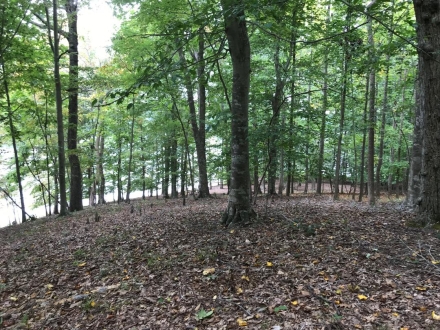
Orange-Blue: Because access to the southeastern section of the park is constricted by the archery range, mountain bike course and a tract of private property, it will take a little doing to get into the area, but the terrain there is very open and enjoyably runnable once you get there.
A brief shuttle ride will take Orange-Blue runners from Shelter 1 to the trailhead on the park road near the park entrance. The distance is about 1 kilometer with the shuttle returning to shelter 1 about every 10 minutes. From the trailhead, there will be a 700 m trail walk to the start. Runners will finish their courses back near the drop-off point and then take the shuttle back to Shelter 1 to download. Again, reference the linked locator map to see this displayed graphically.
Anyone who wishes to do so can walk all at the way from Shelter 1 along the trail that runs next to the park entrance road (see the Locator Map.) The entire route from Shelter 1 to the start will be streamered, but we recommend using the shuttle. In any case, please DO NOT walk along the park entrance road to the trailhead.
Rest rooms are available near registration.
| Location | Fountainhead Regional Park, Main parking area, Fairfax Station, VA (Classic) | ||||||||||||||||||||||||||||||||||||||||
| Registration | No advance registration required. Just show up and have fun! | ||||||||||||||||||||||||||||||||||||||||
| Start Times | Start any time between the specified times (11am - 1:30pm). | ||||||||||||||||||||||||||||||||||||||||
| Schedule | Sunday, September 15
| ||||||||||||||||||||||||||||||||||||||||
| Volunteers |
| ||||||||||||||||||||||||||||||||||||||||
| Location Details |
| ||||||||||||||||||||||||||||||||||||||||
| Course Details | Classic
| ||||||||||||||||||||||||||||||||||||||||
| Course Notes | Classic White/Yellow/Short Orange/Beige:
Just to be clear, the Short Orange course is principally for the NVSO competitors but open to all. The Beige course is likewise a shorter Brown.
Orange and Advanced Courses:
After runners take the short shuttle to the trailhead (see locator map) they will follow yellow streamers down the trail to the start.
| ||||||||||||||||||||||||||||||||||||||||
| Entry Fees | Individual Entries
Note: juniors = under 21
Team or Group Entries Participants are welcome to compete together as a single team entry. Teams containing one or more nonmembers are charged the nonmember individual rate. Teams containing one or more adults are charged the adult individual rate. For teams to receive member or junior rates, all members of the team must be members or juniors, respectively. Each extra team map beyond the first is an additional $2. Individuals or teams desiring to compete on a second course can do so for a reduced fee of $2/map. Important Notes
|
