 Printer-friendly version
 PDF versionShareThis
May 5
Sunday

Pre-registration is required and will open on Monday, April 29 at 6 PM and close at 12 Noon Saturday, May 4. Pre-registration is mandatory.
Please join us for a complete selection of classic courses designed by Peggy Dickison. Rosaryville is a 982-acre day-use state park with miles of hiking/biking and horse trails. We will be operating from the Pavilion Picnic area.
Event Director Workshop: Elevate your volunteerism - become a QOC Event Director! Join Kathleen and Sharmagh for a workshop in Pavilion B from 10:00 to 11:00am. Gain insights from basics to specifics and receive the newly revised QOC Event Director Handbook. Veterans - sign up to learn new practices for a smoother experience. Supporting QOC and fellow members as an Event Director is rewarding so make sure to check the "Yes, I'll be there!" box on the event registration form (and choose a course check-in time after the workshop).
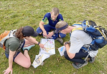
QOC offers free Beginner Training. We’ll train you in the fundamentals on-site, but check out our Your First Event and For Beginners web pages to better prepare for the event. Beginners are also encouraged to watch relevant videos, such as this one created by QOC's instructional guru David Onkst.
FREE EVENT FOR KIDS! Bring your kids along to try the "string-O". What's a string-O, you ask? As their first step towards becoming an orienteer, kids follow a course marked with a yellow string to find their favorite animals. Parents can either wait at the start/finish or can accompany their children along the course. The course is around 250 meters and won't be that far from the registration pavilion. No need to pre-register, just show up, sign the waiver and make your way to the start. This is mainly aimed at kids aged 6 and under but all ages welcome!
 Volunteers: Sign up for a volunteer slot via this form, or email the Event Director directly for other options.
Group Leaders: Even though you will be pre-registering online, please contact the Event Director to inform them of your plans and numbers so that we are prepared to welcome you. Visit our For Group Leaders page for more information about what to expect.
New! LiveLox course codes are available (see end of Course Notes section, below) for all courses for this event.
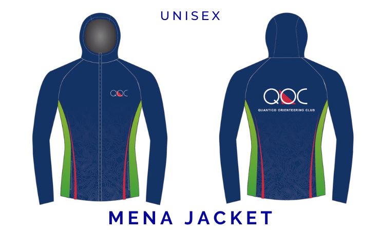
New & Newsiest! The two types of QOC jackets (windbreaker AND softshell) will be available to try on at this event; orders are now being taken until June 21. Full details are on our clothing webpage.
Reminders:
- There is no water on the course. Participants are responsible for their own hydration. A very limited supply of bottled water for emergency use will be on hand with the Meet Director; but it is vital to stay well hydrated. Please come prepared!
- Pet Policy: Leashed pets are allowed in Rosaryville State Park.
- Please note that Rosaryville State Park has installed an automated toll machine for admission. The toll machine accepts credit cards and exact change $1 and $5 bills. Weekend and holiday entry fees are per vehicle: $3 in-state and $5 for out-of-state.
| Location | Rosaryville State Park, Pavilion parking area, Rosaryville, MD (Classic) |
| Registration |  . .
Registration will open at 6pm on Monday April 29 and close at 12 noon on Saturday May 4 (the day before the event). Pre-registration is mandatory.
Who's Registered? Check by clicking here. |
| Start Times | Start times will be by windows (to be defined for this event before registration opens). |
| Schedule | Sunday, May 5| 10:00 am - 3:00 pm | Classic: |
|
| Volunteers | |
| Location Details | Classic
Rosaryville State Park
Pavilion parking area
Rosaryville, MD
Google Map | From I-495 exit 11A, head east on Rt 4 (Penn. Ave) for 3 miles. Turn right on Woodyard Rd/MD-223, then quickly move left to turn left on Marlboro Pike. After 2.8 miles, turn right on Crain Hwy/Rt-301 S, then take the first right on W. Marlton Ave into the Park. Follow O'signs within the park.
Park Entrance Fees: $3/pp in-state, $5/pp out-of-state
Google Maps Link
Apple/iPhone Link |
|
| Course Details | Classic| Course Name | Length (km) | Climb (m) | No. Controls | | White | 2.5 | 40 | 10 | | Yellow | 3.2 | 55 | 9 | | Orange | 5.8 | 110 | 9 | | Brown | 4.1 | 100 | 10 | | Green | 5.7 | 105 | 11 | | Red | 7.7 | 160 | 15 | | Blue | 9.2 | 190 | 20 |
|
| Course Notes | Classic Map/terrain notes:
Rosaryville State Park has a long and illustrious history, hosting George Washington and other famous colonials. The Mt. Airy Mansion—originally built in 1751 and rebuilt after a fire in 1932—sits at the center of the former hunting grounds, which have been used for many years for equestrian events. Horse jumps, marked with Xs, are all over the trails and fields near the mansion. The park is split by the powerline, with both sections featuring a large network of trails. The northern portion of the park includes typical QOC ridge and valley terrain. The park is expanding, and we’re using some not-yet- fieldchecked terrain across the Charles Branch on the north side of the map.
The area near the parking/start/finish has several large fields. The rest of the park is wooded, except for the mansion area, with vegetation thickness varying greatly. Enjoy the open white woods when you’re in them, as they do not predominate (but are delightful!). Light green is most common and is generally good running with reduced visibility. The darker greens are unpleasant to impassable. These areas tend to have a lot of thorns. I have set the courses to avoid the worst areas; if you find yourself in a big thorny area, either you’ve wandered off track or you’re taking a route I didn’t anticipate. There is usually a trail not far away, and they may be your best option. Because many of the trails were built by and for mountain bikers, they tend to be windy and narrow. If you come across a biker, please give way to them.
The area is moderately hilly, but, aside from the northern area along the stream, the hills are not steep or big. The climb is mostly spread out and you won’t notice it too much away from the stream.
Course notes:
Course map scales are likely to be 1:10K for Orange, Green, Red, Blue; and 1:7500 for White, Yellow, and Brown.
Three of the advanced courses cross Charles Branch into the unfieldchecked area. The contours are good, and what is on the map is accurate enough to navigate by. You will find that details and even distinct trails are missing. The controls in this area, therefore, are on bigger features than would ordinarily be used for advanced courses. If you are concerned about navigating in this area, consider running the Green course, which stays south of the creek.
All the courses have a lot of trails; check your compass and map to make sure you’re on the trail you want to be on! It can be easy to get on the wrong one. All courses except Green cross the main road at least once; please watch for park traffic before crossing.
There is no water on any course. Please bring your own water if you need it. If you do not finish your course, as always please report to the Finish and download so we know you are out of the woods. Courses close at 3 p.m.
Map Walk Opportunity:
At 11:15(ish), the course setter (me, Peggy D.) will offer a ~45-minute map walk. Although this will be aimed at orienteers looking to move up to Orange and the advanced courses, anyone is welcome to attend. There is no set maximum number of participants, but in reality there will be, since a larger crowd will be difficult to accommodate (probably once we get 20 or so people, we’ll have to turn away additional people). If there is interest, I may have a second map walk. Keep in mind that you will want to do your course after the map walk! I’ll try to have some maps, but you should plan on bringing your map with you; we will not be going in the areas where the courses go, and you are discouraged from looking
at the course while we are on the map walk.
Note that the current forecast calls for rain on Sunday; if there is moderate or heavier rain, I reserve the right to cancel the map walk.
LiveLox Course Codes:
The 6-character Course Codes for the Livelox Recorder mobile app follow. Using course codes is an easy way to use the Livelox Recorder app without the need to search for an event and pick the right class/course. For this event, they are:
| Course | Code |
|---|
| White | HEAXUH |
| Yellow | PUTZ8A |
| Orange | KPMYHJ |
| Brown | W7BNJM |
| Green | 54XBEB |
| Red | G7K5K2 |
| Blue | 7SAHU8 |
|
| Entry Fees | Individual Entries
Note: juniors = under 21
| |
Club Member, adult |
Club Member, junior |
Non-Member, adult |
Non-Member, junior |
|
$10 |
$5 |
$20 |
$5 |
Group Entries
Participants are welcome to orienteer together as a group (up to the maximum for that event; usually 4). Each member of a group is charged their individual rate as shown above, up to a group total of $30 (maximum), and each receives a map. A group receives one epunch. Individuals or groups desiring to compete on a second course after completing their first can do so for a reduced fee of $2/map subject to approval at the event by the Event Director.
Important Notes
- If you wish to become a QOC member you should join online in advance via this webpage (which also explains the member benefits). Membership is completely optional.
- Most of our events use an 'epunch' timing chip for electronic timing. Individuals or groups without their own epunch will be loaned one for that event. Loaned epunches that are lost incur a $40 replacement fee. Epunches (also known as SI-cards or finger sticks) can be purchased from online vendors as described here.
- Former QOC members who have let their membership lapse pay non-member fees.
- Compasses are available at no charge, but if lost incur a $15 replacement fee.
- Please provide collateral (such as car keys) when borrowing a compass or epunch.
- Beginners are encouraged to watch relevant videos such as this one created by QOC's instructional guru David Onkst
|

![]() Volunteers: Sign up for a volunteer slot via this form, or email the Event Director directly for other options.
Volunteers: Sign up for a volunteer slot via this form, or email the Event Director directly for other options.

