Primary tabs
Sunday
 UPDATE SATURDAY 10PM: The MTBO part of this event has been CANCELLED due to overly wet trail conditions. The classic/foot orienteering will take place at the (same) timing shown below. We hope to reschedule the MTBO in the near future.
Welcome to QOC's National Orienteering Week event, where you just might win a prize randomly as well as have fun orienteering!
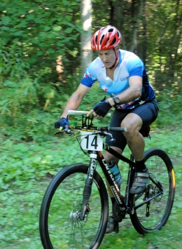
Everyone is welcome at the two one events taking place here on Sunday, Sept. 22. In the morning, weather permitting, bring your bikes and choose between short and long mountain bike orienteering ("MTBO") courses; start anytime between 8:30am - 10:15am and be done by 11am. Then during our regular 'start window' (11am - 1:30) walk or run on foot your choice of a beginner (white or yellow), intermediate (orange), or advanced (brown, green, red) orienteering course.
New to orienteering? We will hold beginner clinics continuously as needed during both events; just tell the friendly folks at registration if you'd like to be in one and they'll take care of you. Also, make sure to check out our Your First Event and For Beginners webpages, and if they don't answer any question you have, just use our Contact Us form and ask away!
Group Leaders: please see our For Group Leaders webpage and then contact us so we can get you registered in advance.
Additional Information:
- Club members who did not sign the (new) liability waivers at our recent Lake Needwood event must do so at their first event of our Sept. - June season.
- Helmets are required for MTBO. Also, participants are encouraged to bring the map carrying system of their preference although there will be safety pins and polyethylene map cases available to support the low-tech option of safety pinning your map to your torso. Note that the map will be 8.5"x11" and that you will be given the map at the start, a minute before starting, so you might want to practice inserting a piece of paper that size into whatever system you will use to be sure you can do it quickly.
- Contour interval for all maps is 5m.
- The term "long" for our longer MTBO course is a bit of a misnomer; this park is so compact that even with the criss-crossing involved in this course the expected shortest time is under 30 minutes, which is actually more typical of a sprint MTBO course than a middle distance course, let alone a true long distance MTBO event.
- Reminder: our entry fees have changed (see below). Cash or check is still the accepted way to pay.
- Epunching will be in use for both events, and since all courses have 20 controls or less, pCards as well as all SI-cards may be used on all courses.
- We will have both SI-8 epunch dibbers and pCards on hand to sell at this event (described here). Costs are discounted $5 through Dec. 31, meaning you can buy an SI-8 dibber for $35 or a pCard for $15 (cash or check).
- Reminder: our entry fees have changed (see below). Cash or check (no credit cards).
- The hours for the Lake Accotink carousel, miniature golf, bike rentals and snackbar are Noon - 7pm at this time of year.
- Dogs are welcome in this park but must be kept on leash at all times. It's really not advised, though, to have them on the trails accompanying any mountain biker.
- Registration fees are the same (but collected separately) for the MTBO and regular/foot orienteering.

Webcam image courtesy of FCPA

| Location | Lake Accotink Park, Lower Parking Lot, Springfield, Virginia | ||||||||||||||||||||||||||||
|---|---|---|---|---|---|---|---|---|---|---|---|---|---|---|---|---|---|---|---|---|---|---|---|---|---|---|---|---|---|
| Registration | No advance registration required. Just show up and have fun! | ||||||||||||||||||||||||||||
| Start Times | You may start your course at any time between 11am - 1:30pm [making sure to be back no later than 3pm.] | ||||||||||||||||||||||||||||
| Schedule |
|
||||||||||||||||||||||||||||
| Volunteers |
|
||||||||||||||||||||||||||||
| Location Details |
Lake Accotink Park, Lower Parking Lot, Springfield, Virginia
From southbound, I-95 Springfield West, first right on BacklickRoad. Left on Highland to Park.Park in the lower parking lot below the dam. From northbound I-95 Springfield West to third stoplight. Right on Hanover, left on Highland (sixth stop sign) to Park.Park in the lower parking lot below the dam. From southbound, I-495 Braddock Road East. Right at second stop light,onto Heming. Follow Heming. Pass under the beltway and continue pass two streets on the right.The park is on the right where the street begins to turn to the left. This is the upper parking lot. Walk downhill next to the fence to the dam.(This avoids the Springfield Interchange with I-95 which may have a back-up). From I-395, Edsall Road West to end. Left on Braddock Road to third stoplight. Right onto Highland to Park. Park in the lower parking lot below the dam. (This avoids the Springfield I-95 Interchange which may have a back-up). |
||||||||||||||||||||||||||||
| Course Details |
|
||||||||||||||||||||||||||||
| Course Notes |
The Lake Accotink map as used for both the MTBO and the regular orienteering course will be at a scale of 1:7,500. A few trails are a bit faded and overgrown from lack of use. Vegetation is some areas is thicker than mapped, but the courses should be fairly runnable. The trails are fairly popular for mountain biking so all runners should be aware of bikers. There is a very dense network of trails in the park. Because they were built by mountain bikers, many of the newer trail tend to loop around.
The MTBO course distances are a rough estimate of the optimal route on trails (in other words, the straight line distances are less and are not shown). For this MTBO event, no shortcutting through woods is allowed, either on the bike or carrying it - you must stay on trails at all times. The MTBO will have the same start and finish as the foot-o. The courses will be mostly on narrow singletrack trails within the park. The courses will have some sections with short, steep uphill and downhill terrain that will require some skill to ride. Obstacles such as downed trees generally have log ramps built up or an alternate ride around. You will probably need to walk bikes over some of the newer downed trees blocking some trails. |
||||||||||||||||||||||||||||
| Entry Fees | Individual Entries (Per Event - MTBO or Foot)
Note: juniors = under 21
Team or Group Entries Participants are welcome to compete together as a single team entry. Teams containing one or more nonmembers are charged the nonmember individual rate. Teams containing one or more adults are charged the adult individual rate. For teams to receive member or junior rates, all members of the team must be members or juniors, respectively. Each extra team map beyond the first is an additional $2. Individuals or teams desiring to compete on a second course can do so for a reduced fee of $2/map. Important Notes
|
Location
Registration
No advance registration required. Just show up and have fun!
Start Times
You may start your course at any time between 11am - 1:30pm [making sure to be back no later than 3pm.]
Schedule
-
Sunday, September 22
11:00 am - 11:00 am -
Sunday, September 22
10:45 am - 1:15 pm -
Sunday, September 22
8:30 am - 10:15 am -
Sunday, September 22
8:30 am - 10:00 am -
Sunday, September 22
11:00 am - 1:30 pm -
Sunday, September 22
3:00 pm - 3:00 pm
Location Details
From southbound, I-95 Springfield West, first right on BacklickRoad. Left on Highland to Park.Park in the lower parking lot below the dam.
From northbound I-95 Springfield West to third stoplight. Right on Hanover, left on Highland (sixth stop sign) to Park.Park in the lower parking lot below the dam.
From southbound, I-495 Braddock Road East. Right at second stop light,onto Heming. Follow Heming. Pass under the beltway and continue pass two streets on the right.The park is on the right where the street begins to turn to the left. This is the upper parking lot. Walk downhill next to the fence to the dam.(This avoids the Springfield Interchange with I-95 which may have a back-up).
From I-395, Edsall Road West to end. Left on Braddock Road to third stoplight. Right onto Highland to Park. Park in the lower parking lot below the dam. (This avoids the Springfield I-95 Interchange which may have a back-up).
Course Details
| Course Name | Length (km) | Climb (m) | No. Controls |
|---|---|---|---|
| White | 3 | 9 | |
| Yellow | 3.3 | 11 | |
| Orange | 4 | 13 | |
| Brown | 4.3 | 14 | |
| Green | 6 | 17 | |
| Red | 7.2 | 20 |
Course Notes
The MTBO course distances are a rough estimate of the optimal route on trails (in other words, the straight line distances are less and are not shown). For this MTBO event, no shortcutting through woods is allowed, either on the bike or carrying it - you must stay on trails at all times. The MTBO will have the same start and finish as the foot-o. The courses will be mostly on narrow singletrack trails within the park. The courses will have some sections with short, steep uphill and downhill terrain that will require some skill to ride. Obstacles such as downed trees generally have log ramps built up or an alternate ride around. You will probably need to walk bikes over some of the newer downed trees blocking some trails.
Entry Fees
Individual Entries (Per Event - MTBO or Foot)
Note: juniors = under 21
| Club Member, adult | Club Member, junior | Non-Member, adult | Non-Member, junior | |
|---|---|---|---|---|
| Epunch Owner | $5 | $5 | $10 | $5 |
| Epunch Borrower | $10 | $5 | $15 | $10 |
Team or Group Entries
Participants are welcome to compete together as a single team entry. Teams containing one or more nonmembers are charged the nonmember individual rate. Teams containing one or more adults are charged the adult individual rate. For teams to receive member or junior rates, all members of the team must be members or juniors, respectively. Each extra team map beyond the first is an additional $2. Individuals or teams desiring to compete on a second course can do so for a reduced fee of $2/map.
Important Notes- At the event, we can only accept payment in cash or check; online, you may use a credit card or PayPal account.
- You may become a member at the event or by joining online via this webpage (which also explains the member benefits). Membership is completely optional.
- Most of our events use an 'epunch' timing chip for electronic timing. Individuals or groups without their own epunch pay a higher entry fee (see above), which includes the loan of an epunch for that event. Loaned epunches that are lost incur a $40 replacement fee. Epunches (also known as SI-cards or finger sticks) are usually available for sale at at each event as described here.
- Compasses are available at no charge, but if lost incur a $15 replacement fee.
- Please provide collateral (driver's license or car keys) when borrowing a compass or epunch.
- For additional safety, whistles are available for sale at $1/each.
- Free beginner instruction is always available - just ask at the registration table.
- QOC Member Discount Cards will debut at this event - save time and save money! Sold only to QOC members in good standing, the 5-pass card is good for five $5 entries and sells for $20 (a 20% discount); the 10-pass sells for $40. A FAQ on the use of these cards will be posted elsewhere on the website once we've heard the first set of questions about them!



