Primary tabs
Sunday
Pre-registration is required and will open Monday, November 30 at 6pm, closing at 12 noon on Saturday Dec. 5, the day before the event. There will be no day-of registration.
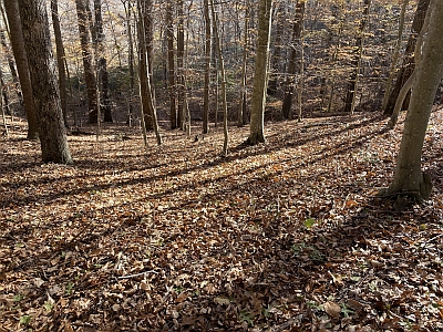
Adventure awaits at PWF/Oak Ridge! Join us for an exciting day of orienteering in the beautiful woods of Prince William Forest Park near Quantico, Virginia. With courses ranging from beginner-friendly to challenging, there’s something for everyone, whether you’re new to orienteering or a seasoned navigator. Don’t miss out on this fun-filled outdoor adventure!
QOC course setter Diana Aleksieva is providing runners with a full set of classic courses, White through Blue, and full course stats and map notes are now posted below.
Parking: This locator map will guide you from I-95 to the Oak Ridge Campground. Watch your speed once inside the park! The speed limit on Scenic Drive is 25 mph, and rangers monitor for speeding. The event check-in location will be near the entrance to Oak Ridge Campground (which is closed to camping during the winter) and easily visible on your right as you arrive and enter the campground to park. Please park only in assigned spaces; follow directions from the parking volunteers wearing orange safety vests. The roadway inside the campground is one-way, and there will be foot traffic moving along and across it, so use caution as you drive.
Carpooling is encouraged due to limited parking at the site.
Parking Entrance Fee: The per-vehicle park entry fee is $20 and can be purchased via the NPS app available at this link. The park does not accept cash.
You can also use a valid 'America the Beautiful' pass or Prince William Forest Park annual pass for entry. (NOTE: The annual park pass is $35; QOC members may want to consider purchasing an annual pass for this great park! Seniors, current or former members of the US Armed Forces, and some other categories of park users are entitled to a free pass for the entire National Park System. See this link for details.)
Everyone must be out of the woods and back to the registration/finish area by 3:00pm. Please allow yourself time to return to the check-in area and download, regardless of whether you have finished, so we know you are out of the woods.
 Have a bit of time to help? Join the crew by signing up via this form or email the Event Director for other volunteering opportunities.
| Volunteers |
|
||||||||||||||||||||||||||||||||||||||||
|---|---|---|---|---|---|---|---|---|---|---|---|---|---|---|---|---|---|---|---|---|---|---|---|---|---|---|---|---|---|---|---|---|---|---|---|---|---|---|---|---|---|
| Course Details |
|
||||||||||||||||||||||||||||||||||||||||
| Course Notes |
All courses have the same start and finish. Both are within 100m of the registration area.
|
||||||||||||||||||||||||||||||||||||||||
| Registration | Pre-registration is required. Registration opens at 6pm on the Monday before this event and closes at 12 noon the day before the event. All registrations are final. Refunds are only issued if the event is canceled. |
||||||||||||||||||||||||||||||||||||||||
| Schedule |
|
||||||||||||||||||||||||||||||||||||||||
| Location | Prince William Forest Park, Oak Ridge Campground, Triangle, Virginia | ||||||||||||||||||||||||||||||||||||||||
| Driving Directions |
Prince William Forest Park, Oak Ridge Campground, Triangle, Virginia
Google Maps Link Apple/iPhone Link
Take I-95 to exit 150 (150B from points north). Head west on Joplin Road (VA-619) and take the second right for the park entrance. Turn left 0.5 miles from the park entrance, onto Scenic Drive. Bear left at the split in the drive to stay on Scenic Dr (signs toward Turkey Run Education Center), continue for 3.6 miles, then turn left on West Gate Fire Rd to the Oak Ridge Campground. (Scenic Drive becomes one-way at that point, and you MUST turn left anyway.) Allow at least 20 minutes drive time inside the park.
Warning: do not use nav software that incorrectly suggests taking Mawavi Rd from Rt 619/Joplin Rd, or, taking Old Blacktop Road from Turkey Run Ridge Camping Area. Both are closed to through traffic. |
||||||||||||||||||||||||||||||||||||||||
| Entry Fees | Individual Entries Note: juniors = under 21
Group Entries Participants are welcome to orienteer together as a group (up to the maximum for that event; usually 4). Each member of a group is charged their individual rate as shown above, up to a group total of $30 (maximum), and each receives a map. A group receives one epunch. Important Notes
|
||||||||||||||||||||||||||||||||||||||||
| FAQ |
|
Course Details
| Course Name | Length (km) | Climb (m) | No. Controls | Scale |
|---|---|---|---|---|
| White | 3.3 | 60 | 10 | 1:5000 |
| Yellow | 3.2 | 60 | 10 | 1:5000 |
| Orange | 3.8 | 90 | 11 | 1:7500 |
| Brown | 3.8 | 65 | 11 | 1:7500 |
| Green | 7.0 | 140 | 15 | 1:10000 |
| Red | 8.4 | 145 | 16 | 1:10000 |
| Blue | 9.5 | 165 | 18 | 1:10000 |
Course Notes
All courses have the same start and finish. Both are within 100m of the registration area.
Map Notes:
- Root stocks are 1.5 meters or larger when mapped and use the green X symbol. It only takes one root sticking up higher than 1.5 meters to be mapped. Mapped root stocks having small root balls but one root sticking up may appear below the mapping threshold from a distance. There are other root stocks close to 1.5m that are not mapped.
- Green Slash is mostly downed trees/branches. Some of the smaller areas are mapped as “walk” instead of “slow run” so they can be seen on the map. The smaller areas can be run through but the larger areas will slow a person down. A fallen trunk symbol is not used. Instead, the large difficult to cross trunks are mapped using the green slash symbol. Virtually all of the deadfall was mapped as low vegetation. However, there are many instances of it being too tall to see over or too tall to run through.
- Mapped cairns in the park are typically well below 1m.
- Ditches tend to be shallow.
- Some mapped intermittent streams are predominantly dry unless in heavy rain.
- There are some old trails and road cuts. Generally, they are not mapped (as rides or roads) unless they are deep enough to be mapped as a ditch.
- Following the current mapping standard, large steep earth banks use the Uncrossable Cliff symbol.
- There is an abundant use of form lines that makes the terrain look steeper than it is in reality.
- Leaf covered hillsides can be slippery. Spiked shoes are recommended.
- Boulders are small: often less than 1 meter.
- Stony ground will not slow you down. It is small scattered rocks and generally not very noticeable.
- Roads with purple X’s are hazardous and not allowed routes.
- Along the trails, there are wooden bridges without railings that cross some minor water channels. The old “bridge” symbol was used so they clearly stand out on the map.
- The east side of the map is Quantico Creek. The width of the creek and the area on the east side of the creek are not mapped other than contours.
- OakRidge map was done by Jon Torrance in 2020 and extensions/updates to the map were done by Ted Good in 2022/2023.
Registration
Pre-registration is required. Registration opens at 6pm on the Monday before this event and closes at 12 noon the day before the event.
All registrations are final. Refunds are only issued if the event is canceled.
Schedule
-
Sunday, December 6
10:00 am - 3:00 pm
Location
Driving Directions
Google Maps Link
Apple/iPhone Link
Warning: do not use nav software that incorrectly suggests taking Mawavi Rd from Rt 619/Joplin Rd, or, taking Old Blacktop Road from Turkey Run Ridge Camping Area. Both are closed to through traffic.
Entry Fees
Individual Entries
Note: juniors = under 21
| Club Member, adult | Club Member, junior | Non-Member, adult | Non-Member, junior |
| $10 | $5 | $20 | $5 |
Group Entries
Participants are welcome to orienteer together as a group (up to the maximum for that event; usually 4). Each member of a group is charged their individual rate as shown above, up to a group total of $30 (maximum), and each receives a map. A group receives one epunch.
Important Notes
- If you wish to become a QOC member you should join online in advance via this webpage (which also explains the member benefits). Membership is completely optional.
- Most of our events use an 'epunch' timing chip for electronic timing. Individuals or groups without their own epunch will be loaned one for that event. Loaned epunches that are lost incur a $60 replacement fee. Epunches (also known as SI-cards or finger sticks) can be purchased from online vendors as described here.
- Former QOC members who have let their membership lapse pay non-member fees.
- Compasses are available at no charge, but if lost incur a $15 replacement fee.
- After completing their first course, orienteers who'd like to try a second one may do so with approval from the Event Director.
- There is no planned, on-site beginner instruction, but beginners are encouraged to watch relevant videos such as this one created by QOC's instructional guru David Onkst
FAQ
- What should I expect at a QOC orienteering event?
Participants navigate through diverse terrain — wooded areas, open fields, and sometimes waterways — using a map and compass. QOC offers a full range of courses to suit every skill level, from beginner-friendly to advanced, so newcomers and experienced orienteers can compete side by side. Events test your navigation skills and endurance, and, for groups, teamwork, all at your own pace.
- What should I bring to a QOC event?
Comfortable outdoor clothing and sturdy footwear suited to the terrain and weather, a water bottle and snacks, and a compass and whistle if you have them — loaners of both are available if needed.
- Do I need experience to try orienteering with QOC?
No experience is necessary. Beginner instruction is offered on-site at every event, and newcomers can prepare in advance with QOC's Your First Event and For Beginners pages, including this instructional video from QOC's David Onkst. Any other questions can be sent through our Contact Form.
- Can I orienteer with a group?
Yes — QOC welcomes groups of orienteers at most events. See our Group Leaders page for tips on running as a group, and check each event's Entry Fees section for group size limits and pricing.
- What is QOC's registration policy?
QOC uses pre-registration only — there is no day-of, on-site registration, and refunds are issued only if an event is cancelled. Each event's own Registration section lists that event's specific sign-up window.
- Are pets allowed at QOC events?
Well-behaved pets are welcome at most venues, but must be kept on a leash and under the owner's control at all times. Check each event's own announcement for any venue-specific restrictions. NOTE: pets are not allowed on shuttle buses.
- How can I volunteer at a QOC event?
QOC runs on volunteer support, from course setting and registration to control pickup — no experience is necessary for most roles. Each event's announcement includes a way to sign up (usually a SignUpGenius link) or to contact that event's director directly to offer help.