| Location | Directions |
|---|---|
|
Pavilion parking area
Google Maps Link Apple/iPhone Link |
From I-495 exit 11A, head east on Rt 4 (Penn. Ave) for 3 miles. Turn right on Woodyard Rd/MD-223, then quickly move left to turn left on Marlboro Pike. After 2.8 miles, turn right on Crain Hwy/Rt-301 S, then take the first right on W. Marlton Ave into the Park. Follow O'signs within the park.
Park Entrance Fees: $3/pp in-state, $5/pp out-of-state |
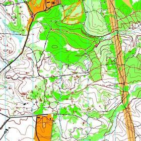
Rosaryville State Park is a 982-acre day-use state park in Prince George's County, Maryland, with miles of trails used by hikers, bikers, and equestrians. At its center stands the historic Mount Airy Mansion, built in 1751 and once home to the Custis family (Martha Washington's family); much of the surrounding land was former farmland and hunting grounds, giving QOC events here a mix of open fields and forest.
The terrain is classic ridge-and-valley country — broad, flat ridges cut by deeply incised streams, where the climb is steepest — and suits a full range of classic courses, from white through blue; the open, rolling ground has also supported mountain bike orienteering courses run alongside the foot courses. Vegetation runs from open, easy woods to dense thorny pockets that can be a real slowdown off-trail, and unmarked rootstocks are common here but are never used as controls, so don't rely on them for navigation. The extensive trail network, heavily used by horses and mountain bikers who have the right of way, makes the park equally workable for beginners and for longer, more demanding routes.
This combination of fields, forest, and trails makes Rosaryville a popular venue for groups and beginners as well as experienced orienteers, and it has hosted the regional Mid-Atlantic Championships.
Registration and starting are usually based out of one of the park's picnic pavilions. The park charges a per-vehicle entrance fee (collected at an automated toll machine, in-state and out-of-state rates apply), and QOC has run events at Rosaryville for many years.