Manassas National Battlefield Park
The first major land battle of the American Civil War took place here in July 1861, as the relatively inexperienced armies of both sides fought what is now known as the Battle of First Manassas. Little more than a year later, battle tested battalions from both sides faced off in the Battle of Second Manassas.
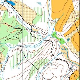
The park is slowly being restored to yield a landscape similar to the one present in the 1860's. QOC has two orienteering maps in this park; the first, Chinn Ridge, is rarely used now due to park restrictions. The second map, Stuart's Hill, includes an area of wetlands restoration as well as a mix of open fields and woods.
| Location | Directions |
|---|---|
| Brownsville Picnic Area | Take I-66 to Exit 47 in Manassas. Go South on Sudley Road (route 234). After a short distance, turn right onto Balls Ford Road (route 621). Proceed ~2 miles, then turn right onto Brady Lane. After a quarter mile, turn right onto Groveton Road (route 622). Go North ~1 mile to the picnic area entrance on the left. Google Maps Link |
Upcoming Events at this Venue
There are currently no events scheduled at this venue in the next six months. Please check back later or consider hosting an event at this venue with full club support.
Sample Orienteering Map