Primary tabs
Sunday
Pre-registration is required and will open Monday, September 28 at 6pm, closing at 12 noon on Saturday Oct. 3, the day before the event. There will be no day-of registration.
Orienteering at Gunston Hall
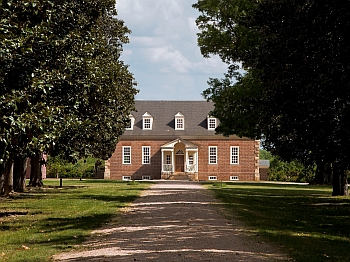
Join the Quantico Orienteering Club on Sunday, October 4 for a great day of orienteering at historic Gunston Hall, the home of George Mason, father of the Bill of Rights.
Gunston Hall packs an impressive variety of terrain into a relatively compact area, making it one of QOC’s most interesting venues. Orienteers can expect a mix of open fields surrounding the historic estate, runnable and occasionally dense forest, rolling terrain, and the steeper reentrant and spur systems descending toward the Potomac River. This variety provides plenty of opportunities to test your navigation skills while enjoying one of Northern Virginia’s most distinctive historic landscapes.
A full range of classic orienteering courses have been designed by Rob Field (details are below), with options suitable for everyone from first-time orienteers and families to experienced competitors looking for a more technical challenge. This year the Red and Blue courses are expanding across Gunston Road into freshly mapped territory!
Beginners are always welcome, and introductory instruction will be available for anyone who would like to learn the basics or brush up on their map-and-compass skills.
This year’s Gunston Hall event will also host the Northern Virginia Senior Olympics (NVSO) Orienteering Competition. We are excited to welcome NVSO athletes to Gunston Hall and introduce even more members of the Northern Virginia community to the sport of orienteering. Registration for NVSO is separate from registering for this event as it spans many events held between September 11 through October 4 2026.
The entrance to Gunston Hall (see directions below) is about 600 meters beyond the Pohick Bay Regional Park entrance on Gunston Road. Please drive with particular caution as you enter Gunston Hall. The first 300 meters of the entrance road has several 90 degree curves and is hemmed in by vegetation reducing the visibility of oncoming vehicles. Parking will be in the lot adjacent to the visitor’s center. The parking lot and the registration site right across the entrance road from it will be easily discernible as you drive in. Port-a-johns will be on site adjacent to check-in.
Volunteer
 Have a bit of time to help? Join the crew by signing up via this form or email the Event Director for other volunteering opportunities.
| Volunteers |
|
||||||||||||||||||||||||||||||||||||||||
|---|---|---|---|---|---|---|---|---|---|---|---|---|---|---|---|---|---|---|---|---|---|---|---|---|---|---|---|---|---|---|---|---|---|---|---|---|---|---|---|---|---|
| Course Details |
|
||||||||||||||||||||||||||||||||||||||||
| Course Notes |
Gunston Hall is a relatively small area, but it provides a taste of many of the terrain types that we find in Northern Virginia. There are large open areas, fast open woods, thick woods with lots of downed trees, steep relief like Pohick Bay, and subtle features like Mason Neck. The map has recently been updated to the standard 5 m contour interval. There are fewer features, trails, and relocation opportunities than are found on many of our maps, so this may not be an event to move up in difficulty. The woods are generally dry, with a few muddy spots. The areas mapped as marshy are mostly easily crossable, as are the creeks. Leaves are still on, so visibility can be poor. There is a lot of long grass in the open fields. Beware of chiggers which may still be active in the park. Reentrants often have downed trees making running up or down difficult. Many new unmapped rootstocks exist. Black X's in the open fields are used to show the park benches that are scattered around the perimeter. In the woods, these X's are used to designate noticeable pieces of old debris (for example, a 50 year old washing machine). Red & Blue courses cross Gunston Road. Use of the road crossing point marked on the map is mandatory. Please heed directions from the volunteer crossing guard positioned at the crossing; please stop if so directed. Controls have been placed near this road crossing to assist in channelizing runners to the designated crossing location. Please move away from the controls quickly to avoid congestion at these controls. Cars are usually speeding. Please stay safe. The map across the road is relatively newly mapped, with vegetation not thoroughly documented, areas of unmapped green; however, the contours are generally accurate. This new map section consists of open plateaus vegetated with 12”-36" high huckleberry bushes that are not too hard to get through. Reentrants do have areas of mountain laurel not well mapped. Out of Bounds: Note the out-of-bounds areas as marked on the map, and also respect private land and the many historic features of the park, marked with either black or burgundy stripes. |
||||||||||||||||||||||||||||||||||||||||
| Registration | Pre-registration is required. Registration opens at 6pm on Monday Sept. 28 and closes at 12 noon Saturday Oct. 3
Who's Registered? Check by clicking here. |
||||||||||||||||||||||||||||||||||||||||
| Schedule |
|
||||||||||||||||||||||||||||||||||||||||
| Location | Gunston Hall, Main parking area, Lorton, Virginia | ||||||||||||||||||||||||||||||||||||||||
| Driving Directions |
From southbound I-95, take exit 163 (Lorton). Go left onto Lorton Rd at the end of exit ramp. Go under the 2nd overpass and turn right onto Lorton Market St, then go ~1.5 miles to the traffic light at Route 1. Go straight through light (the road name changes to Gunston Rd) and go ~4 miles to the entrance to Gunston Hall on left (identified with orienteering sign; overview map here.) |
||||||||||||||||||||||||||||||||||||||||
| Entry Fees | Individual Entries Note: juniors = under 21
Group Entries Participants are welcome to orienteer together as a group (up to the maximum for that event; usually 4). Each member of a group is charged their individual rate as shown above, up to a group total of $30 (maximum), and each receives a map. A group receives one epunch. Important Notes
|
||||||||||||||||||||||||||||||||||||||||
| FAQ |
|
Course Details
| Course Name | Length (km) | Climb (m) | No. Controls | Scale |
|---|---|---|---|---|
| White | 1.8 | 20 | 8 | 1:5000 |
| Yellow | 3.1 | 50 | 10 | 1:5000 |
| Orange | 3.8 | 80 | 13 | 1:7500 |
| Brown | 3.6 | 70 | 9 | 1:7500 |
| Green | 4.4 | 115 | 11 | 1:7500 |
| Red | 5.9 | 130 | 18 | 1:10000 |
| Blue | 8.1 | 180 | 21 | 1:10000 |
Course Notes
Gunston Hall is a relatively small area, but it provides a taste of many of the terrain types that we find in Northern Virginia. There are large open areas, fast open woods, thick woods with lots of downed trees, steep relief like Pohick Bay, and subtle features like Mason Neck. The map has recently been updated to the standard 5 m contour interval. There are fewer features, trails, and relocation opportunities than are found on many of our maps, so this may not be an event to move up in difficulty. The woods are generally dry, with a few muddy spots. The areas mapped as marshy are mostly easily crossable, as are the creeks. Leaves are still on, so visibility can be poor. There is a lot of long grass in the open fields. Beware of chiggers which may still be active in the park. Reentrants often have downed trees making running up or down difficult. Many new unmapped rootstocks exist. Black X's in the open fields are used to show the park benches that are scattered around the perimeter. In the woods, these X's are used to designate noticeable pieces of old debris (for example, a 50 year old washing machine).
Red & Blue courses cross Gunston Road. Use of the road crossing point marked on the map is mandatory. Please heed directions from the volunteer crossing guard positioned at the crossing; please stop if so directed. Controls have been placed near this road crossing to assist in channelizing runners to the designated crossing location. Please move away from the controls quickly to avoid congestion at these controls. Cars are usually speeding. Please stay safe. The map across the road is relatively newly mapped, with vegetation not thoroughly documented, areas of unmapped green; however, the contours are generally accurate. This new map section consists of open plateaus vegetated with 12”-36" high huckleberry bushes that are not too hard to get through. Reentrants do have areas of mountain laurel not well mapped.
Out of Bounds: Note the out-of-bounds areas as marked on the map, and also respect private land and the many historic features of the park, marked with either black or burgundy stripes.
Registration
Pre-registration is required. Registration opens at 6pm on Monday Sept. 28 and closes at 12 noon Saturday Oct. 3

Who's Registered? Check by clicking here.
Schedule
-
Sunday, October 4
10:00 am - 3:00 pm
Location
Driving Directions
From southbound I-95, take exit 163 (Lorton). Go left onto Lorton Rd at the end of exit ramp. Go under the 2nd overpass and turn right onto Lorton Market St, then go ~1.5 miles to the traffic light at Route 1. Go straight through light (the road name changes to Gunston Rd) and go ~4 miles to the entrance to Gunston Hall on left (identified with orienteering sign; overview map here.)
Entry Fees
Individual Entries
Note: juniors = under 21
| Club Member, adult | Club Member, junior | Non-Member, adult | Non-Member, junior |
| $10 | $5 | $20 | $5 |
Group Entries
Participants are welcome to orienteer together as a group (up to the maximum for that event; usually 4). Each member of a group is charged their individual rate as shown above, up to a group total of $30 (maximum), and each receives a map. A group receives one epunch.
Important Notes
- If you wish to become a QOC member you should join online in advance via this webpage (which also explains the member benefits). Membership is completely optional.
- Most of our events use an 'epunch' timing chip for electronic timing. Individuals or groups without their own epunch will be loaned one for that event. Loaned epunches that are lost incur a $60 replacement fee. Epunches (also known as SI-cards or finger sticks) can be purchased from online vendors as described here.
- Former QOC members who have let their membership lapse pay non-member fees.
- Compasses are available at no charge, but if lost incur a $15 replacement fee.
- After completing their first course, orienteers who'd like to try a second one may do so with approval from the Event Director.
- There is no planned, on-site beginner instruction, but beginners are encouraged to watch relevant videos such as this one created by QOC's instructional guru David Onkst
FAQ
- What should I expect at a QOC orienteering event?
Participants navigate through diverse terrain — wooded areas, open fields, and sometimes waterways — using a map and compass. QOC offers a full range of courses to suit every skill level, from beginner-friendly to advanced, so newcomers and experienced orienteers can compete side by side. Events test your navigation skills and endurance, and, for groups, teamwork, all at your own pace.
- What should I bring to a QOC event?
Comfortable outdoor clothing and sturdy footwear suited to the terrain and weather, a water bottle and snacks, and a compass and whistle if you have them — loaners of both are available if needed.
- Do I need experience to try orienteering with QOC?
No experience is necessary. Beginner instruction is offered on-site at every event, and newcomers can prepare in advance with QOC's Your First Event and For Beginners pages, including this instructional video from QOC's David Onkst. Any other questions can be sent through our Contact Form.
- Can I orienteer with a group?
Yes — QOC welcomes groups of orienteers at most events. See our Group Leaders page for tips on running as a group.
- What is QOC's registration policy?
QOC uses pre-registration only — there is no day-of, on-site registration, and refunds are issued only if an event is cancelled. Each event's own Registration section lists that event's specific sign-up window.
- Are pets allowed at QOC events?
Well-behaved pets are welcome at most venues, but must be kept on a leash and under the owner's control at all times. Check each event's own announcement for any venue-specific restrictions.
- How can I volunteer at a QOC event?
QOC runs on volunteer support, from course setting and registration to control pickup — no experience is necessary for most roles. Each event's announcement includes a way to sign up (usually a SignUpGenius link) or to contact that event's director directly to offer help.



