Primary tabs
Sunday
Add to Calendar
(not available for past events)
 Pre-registration is required and will open on Monday, May 4 at 6pm and close at 12 noon on Saturday May 9.
There will be no day-of registration.
Welcome back to the Balls Bluff venue. This event features a fresh set of courses courtesy of course setter Justin Brown. This year we’ve organized bus transportation for participants from Balls Bluff Elementary School to the registration area at the Edwards Landing Pavilion. Participants are asked not to park along the residential streets neighboring the Park (the limited parking at the Pavilion is reserved for volunteers only).
Check in at the registration area will open at about 9:45am, and courses will open at 10:00am. As always, be off the course no later than 3pm, and remember to download at our e-punch station even if you did not finish. We expect the last shuttle returning to the school parking lot to leave at 3:15pm.
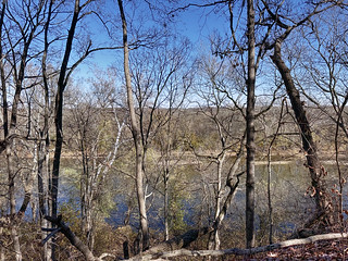
Orienteering at Balls Bluff: Balls Bluff Battlefield Park is the site of the first Civil War battle in Loudoun County (1861). The park has recently undergone restoration to more accurately reflect its 1861 condition, and you are encouraged to tour the area and its National Cemetery near the Potomac River. Click here for a brief history of the battle.
What to Expect: Participants will navigate through diverse terrains, including wooded areas, open fields, and waterways, using a map and compass. This event is designed to test your navigation skills, endurance, and for groups, teamwork. Various courses will be available to accommodate all skill levels:
- Beginner Course: Perfect for newcomers, offering a gentle introduction to orienteering with straightforward checkpoints and kid-friendly terrain. Beginner Instruction will be available.
- Intermediate Course: A bit more challenging, great for those with some orienteering experience looking to improve their skills.
- Advanced Courses: For experienced orienteers seeking a rigorous and demanding course with complex navigation.
- Comfortable outdoor clothing and sturdy footwear
- Water bottle and snacks
- Compass and whistle if you have them. Loaners are available if needed.
 Our club relies on our amazing volunteers! Thanks to you, we’re able to offer an event almost every weekend in the season. We’re always looking for new volunteers to help share the load so that our regulars don’t end up running totally off-course!
If you have a sense of adventure and a little time to spare, join the crew by signing up for a volunteer slot via this form, or email the Event Director for other volunteering opportunities.
Our club relies on our amazing volunteers! Thanks to you, we’re able to offer an event almost every weekend in the season. We’re always looking for new volunteers to help share the load so that our regulars don’t end up running totally off-course!
If you have a sense of adventure and a little time to spare, join the crew by signing up for a volunteer slot via this form, or email the Event Director for other volunteering opportunities.
Beginners: Make sure to check out our Your First Event and Orienteering Techniques For Beginners webpages, and if they don't answer all your questions, just ask them via our Contact Form. We will offer beginner instruction at the event.
Groups: QOC allows groups of up to 4 people to orienteer together. Please see our Group Leaders webpage and then contact the Event Director so they are aware of your plans.
Other notes and reminders:
- QOC will continue to use pre-registration as the ONLY method of signing up for our events. There will be NO day-of, on-site registration. Refunds are paid only in case of event cancellation.
- No water or food will be provided. Participants are responsible for meeting all their own food and hydration needs.
- Restrooms are available near the picnic area.
- Everyone must be out of the woods and back at the registration/finish area by 3:00pm when control pick-up will start. Allow yourself time to get back to the registration area to download, regardless of whether you finished the course. We want to ensure that all participants are safe and accounted for.
- Pets are allowed but must always be kept on a leash and under the owner’s control.
Advance Notice!
Non-citizen orienteers without permanent resident status in the US must contact our May 16 event director before May 11 to discuss access to our event on the Quantico Marine Corps Base (details here).| Volunteers |
|
|||||||||||||||||||||||||||||||||||
|---|---|---|---|---|---|---|---|---|---|---|---|---|---|---|---|---|---|---|---|---|---|---|---|---|---|---|---|---|---|---|---|---|---|---|---|---|
| Course Details |
|
|||||||||||||||||||||||||||||||||||
| Course Notes |
Course Notes
There is a large construction area in the northern section of park marked as out of bounds. This makes a small park even smaller. There are some steep trail sections near the creeks not far from start. There are many trails in this park. Some are indistinct and not mapped. Some areas have many controls near each other, be sure to pay attention the feature and control number to prevent a mis-punch. As of April 4th, most of the woods are nice and open. There are some areas of thorns, but most are noticeable from a distance to avoid. Visibility will probably not be as great by day of the event. There was minimal water in the creeks and no water in the minor water channels. May potentially hang many of the advanced controls/flags low since some may be visible from the many trails, control locations shouldn't be too difficult for the most experienced. White Course: A few legs will go along trails near the bluffs (cliffs). Yellow Course: There are a couple off trail controls. There are a few opportunities for route choice options utilizing the woods vs staying only on trails. Orange Course: This may be a little more challenging than some orange courses, almost close to a Beige course. Most controls are off trail, never too far from a trail in this park. The back stop for this course is the main park entrance road. If you hit the large open field or parking lot, you went too far. Brown Course: This is probably the best advanced course. You will see the entire length of the usable park. If the distance is a little too long, Orange would be a good alternative. Green Course: Had to add a little twist to get in some extra distance. Red Course: This course basically does an out and back of the entire usable park twice. If you don't want to possibly cover the same similar ground multiple times, I'd suggest the Green or Brown course. Map Scale is 1:10,000 for Brown/Green/Red. 1:7,500 for Orange. 1:5,000 for Yellow/White. 2.5 meter contours.
Map Notes
|
|||||||||||||||||||||||||||||||||||
| Registration | Advance registration will be required. The date and time that registration will open will be posted here; usually, registration will open at 6pm on the Monday before the event. |
|||||||||||||||||||||||||||||||||||
| Schedule |
|
|||||||||||||||||||||||||||||||||||
| Location | Balls Bluff Regional Park, Edwards Landing Pavilion (School Parking), Leesburg, Virginia | |||||||||||||||||||||||||||||||||||
| Driving Directions |
Balls Bluff Regional Park, Edwards Landing Pavilion (School Parking), Leesburg, Virginia
Google Maps Link Apple/iPhone Link
Take the Dulles Toll Road or Rt. 7 to the Rt. 15 by-pass in Leesburg. Turn right for about a mile to Battlefield Parkway and then turn right. Balls Bluff Elementary School will be on the right after 0.7 miles. The direction links below will take you to the school parking.
Directions to Edwards Landing from the school: From Battlefield Parkway southbound, turn left near the south end of the school to go east on Hunton Place for 0.3 miles, then turn right at the intersection with Graywood Way/Woods Edge Drive and go 0.1 miles before turning left on Powhatan Ct. The entrance to the small Edwards Landing parking area is on the right side of the turnaround circle. Note to those walking: it's just 0.6 miles, but please be especially careful crossing Battlefield Parkway. Click here for an overview map.
|
|||||||||||||||||||||||||||||||||||
| Entry Fees | Individual Entries Note: juniors = under 21
Group Entries Participants are welcome to orienteer together as a group (up to the maximum for that event; usually 4). Each member of a group is charged their individual rate as shown above, up to a group total of $30 (maximum), and each receives a map. A group receives one epunch. Individuals or groups desiring to compete on a second course after completing their first can do so for a reduced fee of $2/map subject to approval at the event by the Event Director. Important Notes
|
Course Details
| Course Name | Length (km) | Climb (m) | No. Controls | Scale |
|---|---|---|---|---|
| White | 1.7 | 50 | 7 | |
| Yellow | 2.3 | 55 | 8 | |
| Orange | 3.1 | 80 | 9 | |
| Brown | 4.1 | 100 | 9 | |
| Green | 5.3 | 135 | 11 | |
| Red | 7.9 | 185 | 17 |
Course Notes
There is a large construction area in the northern section of park marked as out of bounds. This makes a small park even smaller. There are some steep trail sections near the creeks not far from start. There are many trails in this park. Some are indistinct and not mapped. Some areas have many controls near each other, be sure to pay attention the feature and control number to prevent a mis-punch. As of April 4th, most of the woods are nice and open. There are some areas of thorns, but most are noticeable from a distance to avoid. Visibility will probably not be as great by day of the event. There was minimal water in the creeks and no water in the minor water channels. May potentially hang many of the advanced controls/flags low since some may be visible from the many trails, control locations shouldn't be too difficult for the most experienced.
White Course: A few legs will go along trails near the bluffs (cliffs).
Yellow Course: There are a couple off trail controls. There are a few opportunities for route choice options utilizing the woods vs staying only on trails.
Orange Course: This may be a little more challenging than some orange courses, almost close to a Beige course. Most controls are off trail, never too far from a trail in this park. The back stop for this course is the main park entrance road. If you hit the large open field or parking lot, you went too far.
Brown Course: This is probably the best advanced course. You will see the entire length of the usable park. If the distance is a little too long, Orange would be a good alternative.
Green Course: Had to add a little twist to get in some extra distance.
Red Course: This course basically does an out and back of the entire usable park twice. If you don't want to possibly cover the same similar ground multiple times, I'd suggest the Green or Brown course.
Map Scale is 1:10,000 for Brown/Green/Red. 1:7,500 for Orange. 1:5,000 for Yellow/White. 2.5 meter contours.
Map Notes
A new map has been created using LIDAR using latest mapping standards along with updated property boundaries. The new map has been updated by a novice mapper so keep your expectations low. Many of the features from the previous map have been transferred to new map, but not everything. No rootstocks were transferred from the old map. Most of the dark green vegetation has been transferred since still appears accurate. The light green vegetation has not. Vegetation shouldn't be a major concern for the courses. While course setting did notice some features that could be added to map. There are some pits not mapped and some lighter green vegetation could be mapped in some places like the old map, but were minimal to not copy. Did not add any rootstocks. Many streams were added as default to the map, changed many of these to minor water channels to copy old map. Not sure if these have water most of the year so might be able to just be removed to look more like reentrants.
Registration
Advance registration will be required. The date and time that registration will open will be posted here; usually, registration will open at 6pm on the Monday before the event.
Schedule
-
Sunday, May 10
10:00 am - 3:00 pm
Location
Driving Directions
Google Maps Link
Apple/iPhone Link
Directions to Edwards Landing from the school: From Battlefield Parkway southbound, turn left near the south end of the school to go east on Hunton Place for 0.3 miles, then turn right at the intersection with Graywood Way/Woods Edge Drive and go 0.1 miles before turning left on Powhatan Ct. The entrance to the small Edwards Landing parking area is on the right side of the turnaround circle. Note to those walking: it's just 0.6 miles, but please be especially careful crossing Battlefield Parkway. Click here for an overview map.
Entry Fees
Individual Entries
Note: juniors = under 21
| Club Member, adult | Club Member, junior | Non-Member, adult | Non-Member, junior |
|---|---|---|---|
| $10 | $5 | $20 | $5 |
Group Entries
Participants are welcome to orienteer together as a group (up to the maximum for that event; usually 4). Each member of a group is charged their individual rate as shown above, up to a group total of $30 (maximum), and each receives a map. A group receives one epunch. Individuals or groups desiring to compete on a second course after completing their first can do so for a reduced fee of $2/map subject to approval at the event by the Event Director.
Important Notes
- If you wish to become a QOC member you should join online in advance via this webpage (which also explains the member benefits). Membership is completely optional.
- Most of our events use an 'epunch' timing chip for electronic timing. Individuals or groups without their own epunch will be loaned one for that event. Loaned epunches that are lost incur a $40 replacement fee. Epunches (also known as SI-cards or finger sticks) can be purchased from online vendors as described here.
- Former QOC members who have let their membership lapse pay non-member fees.
- Compasses are available at no charge, but if lost incur a $15 replacement fee.
- Please provide collateral (such as car keys) when borrowing a compass or epunch.
- Beginners are encouraged to watch relevant videos such as this one created by QOC's instructional guru David Onkst



