Primary tabs
Sunday
 Pre-registration is required and will open Monday, Feb 19 at 6 pm. It will close on Saturday, Feb 24 at 12 noon. There will not be any day-of registration.
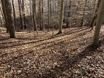
Welcome back to Oak Ridge for our first truly local event at this still-almost-new venue after the 2020 one-day NRE and 2023 Royal Romp national event. The subtle, rolling character of the expansive terrain north and west of the campground--pretty much completely unused except by us--has made Oak Ridge an immediate and challenging favorite. QOC's Vido Aleksiev is providing a full set of classic courses (WYOBGRB) for the event.
See this locator map to guide you from I-95 to Oak Ridge Campground and this one for a layout of the campground and event sites. The event check-in location will be near the entrance to Oak Ridge Campground (which is closed to camping during the Winter) and easily visible on your right as you arrive and enter the campground to park.
For parking, follow directions from the parking volunteers wearing orange safety vests. The roadway inside the campground is one-way, and there will be foot traffic moving along and across it, so use caution as you drive. Oak Ridge Campground is a family camping site, so the single vehicle camping slots and other parking spaces are spread out over three loops. You may have to walk up to 600 meters from your car to the check-in location at the campground entrance.
Parking is somewhat limited at the site, so carpooling is encouraged (and will save $$). Per-vehicle park entry fee is $20; if the pay station at the entrance is not manned, entry fees can be paid at the park HQ before driving out to the check-in site at Turkey Run or via the NPS app available at this link. (NOTE: the fee for an annual park pass is $35; QOC members may want to consider purchasing an annual pass for this great park, either at a park office or a local REI. Seniors, current or former members of the US Armed Forces, and some other categories of park users are entitled to a free passes for the entire National Park System. See this link for details.)
Reminder: This is the same park (albeit a different area) used for our March 16-17 Training Weekend, so a longer-term park pass may be cost-effective. Registration is open until March 9 for the Training Weekend.

Volunteer SignUps: If you'd like to help at this event, click here or contact the Event Director.
Post-event Social: After your run, grab a bite to eat with fellow orienteers at the Panera Bread in Dumfries, located here, just 8 miles north of the park.
Keep in mind:
- All participants must pre-register; there is no day-of registration.
- No food items will be provided.
- Participants are responsible for meeting all their own hydration needs before, during and after their courses.
- As always, please be off the course no later than 3pm and remember to download at our e-punch station even if you did not finish.
- Beginner's instruction will be available.
- For those new to orienteering, make sure to check out our Your First Event and For Beginners webpages, and if they don't answer any question you have, just use our Contact Form and ask.
- Group Leaders (of larger groups): please contact the Event Director so they are aware of your plans.
- Port-a-jons will be located near check-in at the entrance to the Oak Ridge campground. Campground restrooms are all closed for the season.
- Dogs are allowed in the park but must be on the leash at all times.
| Location | Prince William Forest Park, Oak Ridge Campground, Triangle, Virginia | ||||||||||||||||||||||||||||||||
|---|---|---|---|---|---|---|---|---|---|---|---|---|---|---|---|---|---|---|---|---|---|---|---|---|---|---|---|---|---|---|---|---|---|
| Registration |
Registration opens at 6pm on Monday Feb. 19 and closes at 12 noon on Saturday Feb. 25 (the day before the event). Pre-registration is mandatory. Who's Registered? Check by clicking here. |
||||||||||||||||||||||||||||||||
| Start Times | Start times will be by windows (to be defined for this event before registration opens). | ||||||||||||||||||||||||||||||||
| Schedule |
|
||||||||||||||||||||||||||||||||
| Volunteers |
|
||||||||||||||||||||||||||||||||
| Location Details |
Prince William Forest Park, Oak Ridge Campground, Triangle, Virginia
Take I-95 to exit 150 (150B from points north). Head west on Joplin Road (VA-619) and take the second right for the park entrance. Turn left 0.5 miles from the park entrance, onto Scenic Drive. Bear left at the split in the drive to stay on Scenic Dr (signs toward Turkey Run Education Center), continue for 3.6 miles, then turn left on West Gate Fire Rd to the Oak Ridge Campground. (Scenic Drive becomes one-way at that point, and you MUST turn left anyway.) Allow at least 20 minutes drive time inside the park.
Warning: do not use nav software that incorrectly suggests taking Mawavi Rd from Rt 619/Joplin Rd, or, taking Old Blacktop Road from Turkey Run Ridge Camping Area. Both are closed to through traffic. |
||||||||||||||||||||||||||||||||
| Course Details |
|
||||||||||||||||||||||||||||||||
| Course Notes |
Map scale:
- White and Yellow – 1:5000 - Orange and Brown – 1: 7500 - Green, Red and Blue – 1:10000 Contour interval: 5 meters.
Start: All courses use the same start. The start is 150 meters from the event center/registration area. Additional information about this map can be found in the Common Notes section of this webpage. |
||||||||||||||||||||||||||||||||
| Entry Fees | Individual Entries
Note: juniors = under 21
Group Entries Participants are welcome to orienteer together as a group (up to the maximum for that event; usually 4). Each member of a group is charged their individual rate as shown above, up to a group total of $30 (maximum), and each receives a map. A group receives one epunch. Individuals or groups desiring to compete on a second course after completing their first can do so for a reduced fee of $2/map subject to approval at the event by the Event Director. Important Notes
|
Location
Registration
 .
.
Registration opens at 6pm on Monday Feb. 19 and closes at 12 noon on Saturday Feb. 25 (the day before the event). Pre-registration is mandatory.
Who's Registered? Check by clicking here.
Start Times
Start times will be by windows (to be defined for this event before registration opens).
Schedule
-
Sunday, February 25
10:00 am - 3:00 pm
Location Details
Warning: do not use nav software that incorrectly suggests taking Mawavi Rd from Rt 619/Joplin Rd, or, taking Old Blacktop Road from Turkey Run Ridge Camping Area. Both are closed to through traffic.
Course Details
| Course Name | Length (km) | Climb (m) | No. Controls |
|---|---|---|---|
| White | 3.3 | 65 | 11 |
| Yellow | 3.6 | 80 | 11 |
| Orange | 4.4 | 95 | 11 |
| Brown | 3.6 | 85 | 12 |
| Green | 6.6 | 130 | 13 |
| Red | 7.7 | 150 | 16 |
| Blue | 9.9 | 165 | 18 |
Course Notes
- White and Yellow – 1:5000
- Orange and Brown – 1: 7500
- Green, Red and Blue – 1:10000
Contour interval: 5 meters.
Start: All courses use the same start. The start is 150 meters from the event center/registration area.
Finish: The finish is next to the event center/registration area.
Vegetation: The North part of the map is more open and the longer advanced courses runners will enjoy these woods. There are new rootstocks that are not mapped but only a few rootstocks are used as control locations.
Creeks: All courses cross small creeks. All creeks are small enough and easily crossable. For the beginner courses, there are wooden bridges without railings that cross some minor creeks. At the east side of the map is Quantico Creek. The width of the creek and the area on the east side of the creek are not mapped other than contours. No courses use the east side of Quantico Creek.
Road crossing: No courses cross roads. All roads with traffic are hazardous and not allowed routes.
Trails: There are not many trails in that part of the PWF park. Except for the first part, there are no trails on the longer advanced courses. There are some old trails and they are not mapped (as rides or roads) unless they are deep enough to be mapped as a ditch. Some are used as control locations.
Red & Blue courses have a map flip.
Additional information about this map can be found in the Common Notes section of this webpage.
Entry Fees
Individual Entries
Note: juniors = under 21
| Club Member, adult | Club Member, junior | Non-Member, adult | Non-Member, junior |
|---|---|---|---|
| $10 | $5 | $20 | $5 |
Group Entries
Participants are welcome to orienteer together as a group (up to the maximum for that event; usually 4). Each member of a group is charged their individual rate as shown above, up to a group total of $30 (maximum), and each receives a map. A group receives one epunch. Individuals or groups desiring to compete on a second course after completing their first can do so for a reduced fee of $2/map subject to approval at the event by the Event Director.
Important Notes- If you wish to become a QOC member you should join online in advance via this webpage (which also explains the member benefits). Membership is completely optional.
- Most of our events use an 'epunch' timing chip for electronic timing. Individuals or groups without their own epunch will be loaned one for that event. Loaned epunches that are lost incur a $40 replacement fee. Epunches (also known as SI-cards or finger sticks) can be purchased from online vendors as described here.
- Former QOC members who have let their membership lapse pay non-member fees.
- Compasses are available at no charge, but if lost incur a $15 replacement fee.
- Please provide collateral (such as car keys) when borrowing a compass or epunch.
- Beginners are encouraged to watch relevant videos such as this one created by QOC's instructional guru David Onkst



