Primary tabs
Sunday
Add to Calendar
(not available for past events)
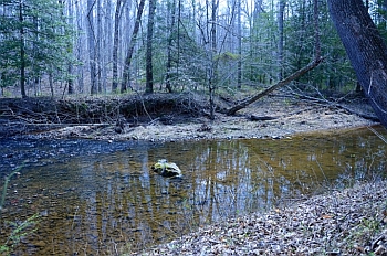 Welcome to QOC's classic orienteering event at the Turkey Run Ridge camping area in Prince William Forest Park. Course setter Keg Good has prepared a full set of fun classic courses (white through blue; detailed notes below) designed to take advantage of the challenging Prince William Forest terrain.
We will also be offering an approximately 4.7 km, ten-control "Fox-O" radio-direction-finding (ARDF) orienteering course, a perfect complement to your classic course for those who would like to try a new orienteering experience. Click here for more details.
Parking is limited at the site, so carpooling is strongly recommended (and will save $)! Note that the fee charged for each vehicle has been raised to $20; if the pay station at the entrance is not manned, entry fees can be paid at the park HQ before driving out to the registration site at Turkey Run. Allow time accordingly. (NOTE: the fee for an annual park pass is $35; QOC members may want to consider purchasing an annual pass for this great park.)
Groups of 8 or more: although you will be pre-registering online, for their awareness please let the Event Director know of your plans and participant numbers.
COVID Risk Reduction Protocols:
As with all 2021-2022 QOC events, this event requires pre-registration via the link below. QOC’s COVID risk reduction protocols, as also enumerated somewhat here, are in effect. Please read these guidelines carefully. Key points:
- PROPERLY WORN MASKS AND SOCIAL DISTANCING ARE REQUIRED at all times when near registration, epunch and any other areas or queues where volunteers and/or participants are congregating.
- No water will be provided. Provide for your own hydration needs before, during, and after the event.
- There is no planned, on-site beginner instruction, but beginners are encouraged to watch relevant videos such as this one created by QOC's instructional guru David Onkst.
- There will be eight 15 minute check-in windows followed by two 45min windows (as for most QOC events this season).
- The size of start teams (groups of individuals orienteering together with one e-punch) on a course must be no more than four (4) individuals (juniors and adults combined).
- Dogs are welcome in this park but must be kept on leash at all times.
- The rest rooms at Turkey Run Ridge will be open for our event--one adjacent to the parking lot and the other at the far end of the campground.
| Volunteers |
|
|||||||||||||||||||||||||||||||||||||||||||||
|---|---|---|---|---|---|---|---|---|---|---|---|---|---|---|---|---|---|---|---|---|---|---|---|---|---|---|---|---|---|---|---|---|---|---|---|---|---|---|---|---|---|---|---|---|---|---|
| Course Details |
|
|||||||||||||||||||||||||||||||||||||||||||||
| Course Notes |
Terrain: PWF spurs and reentrants twist so don’t expect nice, neat parallel features. Once away from the high plateau of Turkey Run (Start and Finish) expect steep gullies and few trails. The forest varies from great visibility/footing to good visibility but club moss underfoot, to various shades of green vegetation and deadfall. In general, the woods will not be as open as what you see when driving in. Intermittent trail/ditch/gully/ride/contour features are mostly the remnants of old roads.
Vegetation: Green spots tend to be mountain laurel or holly clusters. Large areas of green tend to be deadfall (usually pine trees). In some areas, (Blue, Red courses) vegetation includes briars. Dark green should be treated as an impassable feature. Rootstocks: Most of the mapped rootstocks have eroded away to something normally not mapped-new ones are not mapped. Most of the wide reentrant bottoms are semi-grassed over. Some with scattered trees and some mountain laurel that can be thick in places. Rock: Not all rocks, cliffs, and rock piles (cairns) are mapped. Isolated boulders and cliffs can be quite small. Water: All beaver dams, i.e., ponds, are gone. There are no uncrossable creeks. Some areas may be marshy but the current forecast does not call for rain (at the time this was written at least!). Course map scale: 1:5000 for white & yellow, 1:7500 for orange & brown, and 1:10000 for green, red and blue courses. Course-specific comments:
|
|||||||||||||||||||||||||||||||||||||||||||||
| Registration | Registration for this event will open at 6pm on Monday Dec. 6 via this link. Registration will close no later than Noon on Saturday Dec. 11. Who's registered? Check by clicking here. Sorting by column is possible too - just click on the column name. |
|||||||||||||||||||||||||||||||||||||||||||||
| Schedule |
|
|||||||||||||||||||||||||||||||||||||||||||||
| Location | Prince William Forest Park, Turkey Run Ridge, Triangle, Virginia | |||||||||||||||||||||||||||||||||||||||||||||
| Driving Directions |
Take I-95 to exit 150 (150B from points north). Head west on Joplin Road (VA-619) and take the second right for the park entrance. Turn left 0.5 miles from the park entrance, onto Scenic Drive. Bear left at the split in the drive following signs for the Turkey Run Education Center, then turn right at the sign shortly after the split for the Turkey Run Education Center & Campground. Driving time inside the park is ~15 minutes. |
|||||||||||||||||||||||||||||||||||||||||||||
| Entry Fees | Individual Entries
Note: juniors = under 21
Group Entries Participants are welcome to orienteer together as a group (up to the maximum for that event; usually 4). Each member of a group is charged their individual rate as shown above, up to a group total of $30 (maximum), and each receives a map. A group receives one epunch. Individuals or groups desiring to compete on a second course after completing their first can do so for a reduced fee of $2/map subject to approval at the event by the Event Director. Important Notes
|
Course Details
| Course Name | Length (km) | Climb (m) | No. Controls | Scale |
|---|---|---|---|---|
| White | 1.8 | 80 | 7 | |
| Yellow | 2.7 | 90 | 10 | |
| Orange | 4.5 | 185 | 12 | |
| Brown | 4.8 | 170 | 7 | |
| Green | 5.3 | 185 | 12 | |
| Red | 7.2 | 210 | 10 | |
| Blue | 9.1 | 355 | 14 | |
| Ardf | 4.7 | 115 | 10 |
Course Notes
Vegetation: Green spots tend to be mountain laurel or holly clusters. Large areas of green tend to be deadfall (usually pine trees). In some areas, (Blue, Red courses) vegetation includes briars. Dark green should be treated as an impassable feature.
Rootstocks: Most of the mapped rootstocks have eroded away to something normally not mapped-new ones are not mapped. Most of the wide reentrant bottoms are semi-grassed over. Some with scattered trees and some mountain laurel that can be thick in places.
Rock: Not all rocks, cliffs, and rock piles (cairns) are mapped. Isolated boulders and cliffs can be quite small.
Water: All beaver dams, i.e., ponds, are gone. There are no uncrossable creeks. Some areas may be marshy but the current forecast does not call for rain (at the time this was written at least!).
Course map scale: 1:5000 for white & yellow, 1:7500 for orange & brown, and 1:10000 for green, red and blue courses.
Course-specific comments:
- White: if you look hard enough, you will see some controls that are not yours.
- Yellow: will probably get wet feet. Watch for moving cars in the parking areas. Avoid going through occupied campsites.
- Red: should be fun and challenging. There will be vegetation decisions.
- Blue: There is text in the course codes for a map correction. There will be vegetation decisions.
Registration
Registration for this event will open at 6pm on Monday Dec. 6 via this link. Registration will close no later than Noon on Saturday Dec. 11.
Who's registered? Check by clicking here. Sorting by column is possible too - just click on the column name.
Schedule
-
Sunday, December 12
5:00 am - 10:00 am
Location
Driving Directions
Take I-95 to exit 150 (150B from points north). Head west on Joplin Road (VA-619) and take the second right for the park entrance. Turn left 0.5 miles from the park entrance, onto Scenic Drive. Bear left at the split in the drive following signs for the Turkey Run Education Center, then turn right at the sign shortly after the split for the Turkey Run Education Center & Campground. Driving time inside the park is ~15 minutes.
Google Maps Link
Entry Fees
Individual Entries
Note: juniors = under 21
| Club Member, adult | Club Member, junior | Non-Member, adult | Non-Member, junior |
|---|---|---|---|
| $10 | $5 | $20 | $5 |
Group Entries
Participants are welcome to orienteer together as a group (up to the maximum for that event; usually 4). Each member of a group is charged their individual rate as shown above, up to a group total of $30 (maximum), and each receives a map. A group receives one epunch. Individuals or groups desiring to compete on a second course after completing their first can do so for a reduced fee of $2/map subject to approval at the event by the Event Director.
Important Notes- If you wish to become a QOC member you should join online in advance via this webpage (which also explains the member benefits). Membership is completely optional.
- Most of our events use an 'epunch' timing chip for electronic timing. Individuals or groups without their own epunch will be loaned one for that event. Loaned epunches that are lost incur a $40 replacement fee. Epunches (also known as SI-cards or finger sticks) can be purchased from online vendors as described here.
- Former QOC members who have let their membership lapse pay non-member fees.
- Compasses are available at no charge, but if lost incur a $15 replacement fee.
- Please provide collateral (such as car keys) when borrowing a compass or epunch.
- There is no planned, on-site beginner instruction, but beginners are encouraged to watch relevant videos such as this one created by QOC's instructional guru David Onkst



