Primary tabs
Sunday
Add to Calendar
(not available for past events)
Pre-registration is required and will open Monday, September 21 at 6pm, closing at 12 noon on Saturday, Sept. 26, the day before the event. There will be no day-of registration.
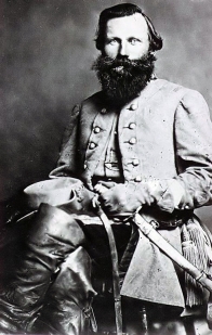
Manassas National Battlefield Park was the site of two major Civil War battles — the First Battle of Manassas in July 1861 and, just over a year later, the Second Battle of Manassas. QOC orienteers at Stuart's Hill, a section of the park being gradually restored toward its 1860s landscape of open fields, woods, and wetlands.
This event will feature classic (i.e. point to point, in order) courses for the beginner (white and yellow) and intermediate (orange) courses. [SATURDAY EVENING UPDATE to course setter notes are below.]
The advanced course will be a Score-O this year to give runners a greater variety of route options. Score-O runners will punch the start and then they will have a 1 hour time limit. Runners will need a watch (or phone) to keep track of their time on course. Each of the 22 controls is worth 1 point. Controls can be punched in any order (controls can only be punched once). Punching the finish stops your clock. For every minute late past 1 hour, there will be a 1 point penalty. Don’t be late! Score-O is ranked first by total controls punched (minus penalties) and then by time.
This event may sell out (i.e. reach our maximum capacity), so we recommend registering sooner rather than later. We also recommend carpooling due to parking constraints. JROTC coaches must also register cadets using the individual/group form used by non-JROTC participants.
Volunteer
 Have a bit of time to help? Join the crew by signing up via this form or email the Event Director for other volunteering opportunities.
| Volunteers |
|
|||||||||||||||||||||||||
|---|---|---|---|---|---|---|---|---|---|---|---|---|---|---|---|---|---|---|---|---|---|---|---|---|---|---|
| Course Details |
|
|||||||||||||||||||||||||
| Course Notes |
The Manassas map uses an older symbol set and is quite green this time of year. Expect thorns near the edges of fields. The darker yellow symbol represent fields, the ones on the east have been mowed, the ones on the west have not yet been mowed (but that could change by the event). Light yellow also represent fields that are typically not mowed and left fallow. Mapped rootstocks are 1.5m and current as of this spring. Long pants and leg protection is highly recommended, especially for Score-O runners. Ticks and chiggers are likely abundant, but insect repellent has been effective during vetting. On the course maps, black X's typically represent derelict farm equipment and junk, and black O's represent historic information signs. Saturday Update: The rain from the edge of the nor’easter passing by has balanced the dryness from the summer drought. Marshes and seasonal streams should generally be accurately mapped. Score-O and Orange courses will cross Young’s Branch Creek. Sure-footed orienteers who take an extra moment will be able to find dry crossings, but runners on a deadline should expect to get their shoes wet. Additional Note: Manassas parks are popular with equestrian users. Runners on trails may encounter equestrians; they should yield and move to the side of the trail and heed any rider directions. |
|||||||||||||||||||||||||
| Registration | Pre-registration is required. Registration opens at 6pm on the Monday before this event and closes at 12 noon the day before the event. JROTC Coaches: unlike most QOC events, for this event you will need to register cadets using the same individual/group registration used by non-JROTC. Enter your JROTC unit name in the 'Youth Group Affiliation' field if you wish.
Who's Registered? Check by clicking here.
|
|||||||||||||||||||||||||
| Schedule |
|
|||||||||||||||||||||||||
| Location | Manassas National Battlefield Park, Brownsville Picnic Area, Manassas, Virginia | |||||||||||||||||||||||||
| Driving Directions |
Manassas National Battlefield Park, Brownsville Picnic Area, Manassas, Virginia
Google Maps Link Apple/iPhone Link Take I-66 to Exit 47 in Manassas. Go South on Sudley Road (route 234). After a short distance, turn right onto Balls Ford Road (route 621). Proceed ~2 miles, then turn right onto Groveton Road (route 622). Go North ~1 mile to the picnic area entrance on the left. |
|||||||||||||||||||||||||
| Entry Fees | Individual Entries Note: juniors = under 21
Group Entries Participants are welcome to orienteer together as a group (up to the maximum for that event; usually 4). Each member of a group is charged their individual rate as shown above, up to a group total of $30 (maximum), and each receives a map. A group receives one epunch. Important Notes
|
|||||||||||||||||||||||||
| FAQ |
|
Course Details
| Course Name | Length (km) | Climb (m) | No. Controls | Scale |
|---|---|---|---|---|
| White | 2.2 | 50 | 8 | 1:5000 |
| Yellow | 2.6 | 90 | 9 | 1:5000 |
| Orange | 4.8 | 120 | 12 | 1:7500 |
| Score-O | 9.5 | 190 | 22 | 1:7500 |
Course Notes
The Manassas map uses an older symbol set and is quite green this time of year. Expect thorns near the edges of fields. The darker yellow symbol represent fields, the ones on the east have been mowed, the ones on the west have not yet been mowed (but that could change by the event). Light yellow also represent fields that are typically not mowed and left fallow. Mapped rootstocks are 1.5m and current as of this spring.
Long pants and leg protection is highly recommended, especially for Score-O runners. Ticks and chiggers are likely abundant, but insect repellent has been effective during vetting.
On the course maps, black X's typically represent derelict farm equipment and junk, and black O's represent historic information signs.
Saturday Update: The rain from the edge of the nor’easter passing by has balanced the dryness from the summer drought. Marshes and seasonal streams should generally be accurately mapped.
Score-O and Orange courses will cross Young’s Branch Creek. Sure-footed orienteers who take an extra moment will be able to find dry crossings, but runners on a deadline should expect to get their shoes wet.
Additional Note: Manassas parks are popular with equestrian users. Runners on trails may encounter equestrians; they should yield and move to the side of the trail and heed any rider directions.
Registration
Pre-registration is required. Registration opens at 6pm on the Monday before this event and closes at 12 noon the day before the event.
JROTC Coaches: unlike most QOC events, for this event you will need to register cadets using the same individual/group registration used by non-JROTC. Enter your JROTC unit name in the 'Youth Group Affiliation' field if you wish.
 .
.
Who's Registered? Check by clicking here.
Schedule
-
Sunday, September 27
10:00 am - 3:00 pm
Location
Driving Directions
Google Maps Link
Apple/iPhone Link
Take I-66 to Exit 47 in Manassas. Go South on Sudley Road (route 234). After a short distance, turn right onto Balls Ford Road (route 621). Proceed ~2 miles, then turn right onto Groveton Road (route 622). Go North ~1 mile to the picnic area entrance on the left.
Entry Fees
Individual Entries
Note: juniors = under 21
| Club Member, adult | Club Member, junior | Non-Member, adult | Non-Member, junior |
| $10 | $5 | $20 | $5 |
Group Entries
Participants are welcome to orienteer together as a group (up to the maximum for that event; usually 4). Each member of a group is charged their individual rate as shown above, up to a group total of $30 (maximum), and each receives a map. A group receives one epunch.
Important Notes
- If you wish to become a QOC member you should join online in advance via this webpage (which also explains the member benefits). Membership is completely optional.
- Most of our events use an 'epunch' timing chip for electronic timing. Individuals or groups without their own epunch will be loaned one for that event. Loaned epunches that are lost incur a $60 replacement fee. Epunches (also known as SI-cards or finger sticks) can be purchased from online vendors as described here.
- Former QOC members who have let their membership lapse pay non-member fees.
- Compasses are available at no charge, but if lost incur a $15 replacement fee.
- After completing their first course, orienteers who'd like to try a second one may do so with approval from the Event Director.
FAQ
- What should I expect at a QOC orienteering event?
Participants navigate through diverse terrain — wooded areas, open fields, and sometimes waterways — using a map and compass. QOC offers a full range of courses to suit every skill level, from beginner-friendly to advanced, so newcomers and experienced orienteers can compete side by side. Events test your navigation skills and endurance, and, for groups, teamwork, all at your own pace.
- What should I bring to a QOC event?
Comfortable outdoor clothing and sturdy footwear suited to the terrain and weather, a water bottle and snacks, and a compass and whistle if you have them — loaners of both are available if needed.
- Do I need experience to try orienteering with QOC?
No experience is necessary. Beginner instruction is offered on-site at every event, and newcomers can prepare in advance with QOC's Your First Event and For Beginners pages, including this instructional video from QOC's David Onkst. Any other questions can be sent through our Contact Form.
- Can I orienteer with a group?
Yes — QOC welcomes groups of orienteers at most events. See our Group Leaders page for tips on running as a group.
- What is QOC's registration policy?
QOC uses pre-registration only — there is no day-of, on-site registration, and refunds are issued only if an event is cancelled. Each event's own Registration section lists that event's specific sign-up window.
- Are pets allowed at QOC events?
Well-behaved pets are welcome at most venues, but must be kept on a leash and under the owner's control at all times. Check each event's own announcement for any venue-specific restrictions.
- How can I volunteer at a QOC event?
QOC runs on volunteer support, from course setting and registration to control pickup — no experience is necessary for most roles. Each event's announcement includes a way to sign up (usually a SignUpGenius link) or to contact that event's director directly to offer help.



