Primary tabs
Sunday
Add to Calendar
(not available for past events)
Pre-registration is required for this event, opening Monday, February 16 at 6pm and closing Saturday February 21 at 12 noon. There will be no day-of registration.
Continue to challenge our winter weather by orienteering! We hope to see lots of folks out to experience McKeldin's hilly terrain and courses set by first time course designer David Cynamon. The McKeldin area of Patapsco hasn’t been visited by QOC for several years, and David has a full set of courses planned (2 beginner, 1 intermediate, 5 advanced). Detailed course notes are posted below.
Please note that Patapsco Valley State Park has a strict rain policy, which will force us to postpone or cancel the event in case of more than 1/4” of precipitation within the 24 hours preceding the event. This may include snow/ice melt, so please check the event status on this webpage late Saturday evening and/or early Sunday morning before traveling to the meet. If we cancel the event, we will fully refund all registration payments.
Volunteer
We’re always looking for new and seasoned volunteers to help our events run smoothly! If you have a little time to spare, join the crew by signing up via this form or email the Event Director directly.
What to Expect
Participants will navigate through diverse terrains, including wooded areas, open fields, and waterways, using a map and compass. This event is designed to test your navigation skills, endurance, and for groups, teamwork. Various courses will be available to accommodate all skill levels:
- Beginner Courses: Perfect for newcomers, offering a gentle introduction to orienteering with straightforward checkpoints and kid-friendly terrain. Beginner Instruction will be available.
- Intermediate Course: A bit more challenging, great for those with some orienteering experience looking to improve their skills.
- Advanced Courses: For experienced orienteers seeking a rigorous and demanding course with complex navigation.
What to Bring
- Comfortable outdoor clothing and sturdy footwear appropriate for the weather.
- Water bottle and snacks.
- Compass and whistle if you have them. Loaners are available if needed.
- Dogs are permitted at this event but must be leashed at all times.
Park Entrance Fee
There is a park entrance fee ($2 per vehicle for MD residents and $4 per vehicle for others, $10 per bus (holding more than 9 passengers). Bring exact change since the park entrance fee will likely be collected using an honor system, and a ranger may not be on duty to provide change. Please remember to pay the fee – our future use of the park will be compromised if there is a gross mismatch between number of participants and collected fees.
Parking and Check-in Details
Check-in is at shelter 576 near the disc golf course. Check-in will open about 9:45am and courses will open at 10:00am. There is a sizable parking lot near the shelter, and an overflow area on the far side of the disc golf course. Follow the signs to the parking area once you enter the park. Portable toilets will be set up in the parking lot.
Everyone must be out of the woods and back at the registration/finish area by 3:00pm when we will begin picking up the controls. Allow yourself time to get back to the registration area and download regardless of whether you have finished. We want to make sure of everyone’s safety and status.
Groups
QOC allows groups of up to 4 people to orienteer together. Any youth or large groups attending this event should contact the Event Director in advance so that we can coordinate pre-registration for your group. Details and the required waiver form can be found on our For Group Leaders webpage.
Beginners
As mentioned, beginner instruction will be offered. If you are new to orienteering, welcome! Please make sure to check out our Your First Event and For Beginners webpages. Beginners are also encouraged to watch relevant videos such as this one created by QOC's instructional guru David Onkst. If you still have remaining questions, just use our Contact Form and ask.
| Volunteers |
|
||||||||||||||||||||||||||||||||||||||||||||||||||
|---|---|---|---|---|---|---|---|---|---|---|---|---|---|---|---|---|---|---|---|---|---|---|---|---|---|---|---|---|---|---|---|---|---|---|---|---|---|---|---|---|---|---|---|---|---|---|---|---|---|---|---|
| Course Details |
|
||||||||||||||||||||||||||||||||||||||||||||||||||
| Course Notes |
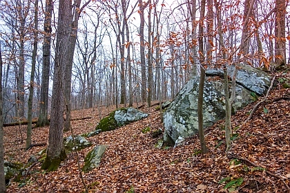
The McKeldin area has some of the steeper terrain amongst our venues and most of the courses have more climb than usual - consider moving down a level if unsure whether your legs are up to it. The terrain is generally runnable with good visibility, but has some areas with deadfall and barberry bushes may slow you down. White and Yellow courses have about 3.5% climb, Orange, Beige, Brown, and Green have about 4.5% climb, Red and Blue have over 5%. I tried to keep courses on the shorter side because of the climb and kept start and finish close to the registration area so you can maximize your time on the courses. (if it's still icy while still safe to have the event, metal studs are recommended for going off trail) Last field check updates Fall 2024 & Trail updates in 2025 by John Blaisdell; map notes from then:
|
||||||||||||||||||||||||||||||||||||||||||||||||||
| Registration | Advance registration is required. Registration opens Monday, Feb. 16 at 6pm and closes Saturday Feb. 21 at 12 noon. |
||||||||||||||||||||||||||||||||||||||||||||||||||
| Schedule |
|
||||||||||||||||||||||||||||||||||||||||||||||||||
| Location | Patapsco Valley State Park, McKeldin Area, Shelter 576, Marriottsville, Maryland | ||||||||||||||||||||||||||||||||||||||||||||||||||
| Driving Directions |
Patapsco Valley State Park, McKeldin Area, Shelter 576, Marriottsville, Maryland
Google Maps Link Apple/iPhone Link From I-695/I-70 West take I-70 to Marriottsville Rd. (Exit 83). Go North on Marriottsville Rd. for 4 miles to the park entrance on the right. After paying park entrance fees, follow O-signs to shelter #576. From I-70 East take Rt. 40 (Exit 82, Balt. Natl. Pike) to Marriottsville Rd. Turn left. Park entrance is 5 miles on the right. After paying park entrance fees, follow O-signs to shelter #576. |
||||||||||||||||||||||||||||||||||||||||||||||||||
| Entry Fees | Individual Entries Note: juniors = under 21
Group Entries Participants are welcome to orienteer together as a group (up to the maximum for that event; usually 4). Each member of a group is charged their individual rate as shown above, up to a group total of $30 (maximum), and each receives a map. A group receives one epunch. Individuals or groups desiring to compete on a second course after completing their first can do so for a reduced fee of $2/map subject to approval at the event by the Event Director. Important Notes
|
Course Details
| Course Name | Length (km) | Climb (m) | No. Controls | Scale |
|---|---|---|---|---|
| White | 2.1 | 75 | 8 | |
| Yellow | 2.8 | 100 | 10 | |
| Orange | 4.2 | 190 | 11 | |
| Beige | 2.2 | 115 | 5 | |
| Brown | 3.6 | 160 | 8 | |
| Green | 4.4 | 195 | 9 | |
| Red | 7.6 | 390 | 14 | |
| Blue | 8.4 | 475 | 19 | |
| Blue |
Course Notes
The McKeldin area has some of the steeper terrain amongst our venues and most of the courses have more climb than usual - consider moving down a level if unsure whether your legs are up to it. The terrain is generally runnable with good visibility, but has some areas with deadfall and barberry bushes may slow you down. White and Yellow courses have about 3.5% climb, Orange, Beige, Brown, and Green have about 4.5% climb, Red and Blue have over 5%. I tried to keep courses on the shorter side because of the climb and kept start and finish close to the registration area so you can maximize your time on the courses. (if it's still icy while still safe to have the event, metal studs are recommended for going off trail)
Last field check updates Fall 2024 & Trail updates in 2025 by John Blaisdell; map notes from then:
Map is 1:10,000 base with 5 meter contours. Map converted to current symbol set 2/2024 but some of the gaps between symbols aren't up to code. Map Notes:
- Rides are mostly old trails. They can be seen on the ground but are mostly over grown. Don't rely on them for quicker running.
- Orienteers should avoid running along disc golf fairways, especially if they are in use. Disc golf 'baskets' are marked on the maps as very small light gray circles; they may be hard to see on the map especially at 1:10000 scale.
- There is a large deer population. Deer tracks are not mapped.
- Larger cliffs have tick marks on the symbols, smaller ones don't. In congested areas all the tick marks are left off.
- Vegetation:
- There are some small thorny bushes; most are easily avoided but larger or denser areas tend to be mapped.
- Fight in all cases should be considered impassable.
- Most of the green is barberry (i.e. thorny) and spreading rapidly (as of 2024).
- There are some light green mountain laurel in McKeldin.
- Rootstocks on the map were 2 meter when mapped but some were mapped a number of years ago so may not be there or are smaller.
- Rock/cliff at least 1 foot in some diameter
- Stony ground is any visual rocks below mapping threshold.
- Woods are very open and therefore fast.
Registration
Advance registration is required. Registration opens Monday, Feb. 16 at 6pm and closes Saturday Feb. 21 at 12 noon.
Schedule
-
Sunday, February 22
10:00 am - 3:00 pm
Location
Driving Directions
Google Maps Link
Apple/iPhone Link
From I-695/I-70 West take I-70 to Marriottsville Rd. (Exit 83). Go North on Marriottsville Rd. for 4 miles to the park entrance on the right. After paying park entrance fees, follow O-signs to shelter #576.
From I-70 East take Rt. 40 (Exit 82, Balt. Natl. Pike) to Marriottsville Rd. Turn left. Park entrance is 5 miles on the right. After paying park entrance fees, follow O-signs to shelter #576.
Entry Fees
Individual Entries
Note: juniors = under 21
| Club Member, adult | Club Member, junior | Non-Member, adult | Non-Member, junior |
|---|---|---|---|
| $10 | $5 | $20 | $5 |
Group Entries
Participants are welcome to orienteer together as a group (up to the maximum for that event; usually 4). Each member of a group is charged their individual rate as shown above, up to a group total of $30 (maximum), and each receives a map. A group receives one epunch. Individuals or groups desiring to compete on a second course after completing their first can do so for a reduced fee of $2/map subject to approval at the event by the Event Director.
Important Notes
- If you wish to become a QOC member you should join online in advance via this webpage (which also explains the member benefits). Membership is completely optional.
- Most of our events use an 'epunch' timing chip for electronic timing. Individuals or groups without their own epunch will be loaned one for that event. Loaned epunches that are lost incur a $40 replacement fee. Epunches (also known as SI-cards or finger sticks) can be purchased from online vendors as described here.
- Former QOC members who have let their membership lapse pay non-member fees.
- Compasses are available at no charge, but if lost incur a $15 replacement fee.
- Please provide collateral (such as car keys) when borrowing a compass or epunch.
- Beginners are encouraged to watch relevant videos such as this one created by QOC's instructional guru David Onkst



