Primary tabs
Saturday
Add to Calendar
(not available for past events)
Pre-registration is required and will open on Monday, Feb. 3 at 6pm and close at noon 6 PM on *Friday* Feb. 7.
There will be no day-of registration.
TIME TO BUMBLE!
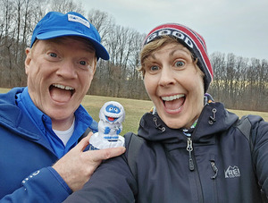
It’s (lucky) year 13 of the annual Super Bowl Saturday Bumble and this year the excitement will be at Fountainhead Regional Park with courses for all skill levels. Come out and enjoy fun in the woods and fun snapping pics with the Abominable “Bumble” snow monster.
The main event of the Bumble is the Mass Start race, which comprises five advanced courses equivalent to beige – blue. The controls are spread over five “windows” and each course level requires a different “handicap” of windows that must be run. For instance, Beige must do one window; blue must do five. Click here to read the full description. It is a super fun style of orienteering with options for bonus time reductions! If you have never tried it but have been successfully completing orange level courses for a while, give this a try. Click here to see last year's course map, and here to view 2024 Bumble photos. There will also be great white, yellow, and orange courses winding through classic ridge and valley terrain.
The mass start will be at 12:00pm for those advanced course runners who want to participate. If you want to run a Bumble advanced course, but are not comfortable with a mass start, please sign up for one of the other start time windows. Mass starters, please be sure to arrive early to avoid a last-minute rush.
The Park very kindly agreed to close the park to mountain bikers during our event so that we can avoid collisions. Just beware of any rogue cyclists!
If the weather is nice, consider bringing lunch and lawn chairs so you can hang out and chat about your courses. It is especially fun to compare window routes. As usual, there will be prizes for the top Bumble winners!
Volunteer Sign Ups: If you can help at this event please contact the Event Director.
Post-Event Social: After your run, grab a bite to eat with fellow orienteers at Chloez Cafe, located here, 7 miles north of the park.
Our Super (Bowl) Poll Is Back!: Last year, the team that more registrants wanted to win - and thought would win - did win ... Will our streak continue? You'll have a chance to vote during registration (and to see the counts as they come in).
PLEASE read ALL meet notes below for important details:
- CLICK HERE TO READ HOW THE BUMBLE WORKS!
- Separate starts for Bumble courses and White/Yellow/Orange courses; both are very close to parking area.
- White, Yellow, and Orange courses will have regular check in/start windows from 9:45am to 1:15pm. (Yes, you are welcome to register for the 11:45am-12:15pm window).
- Advanced (Bumble) courses will have a MASS START at NOON. Please be ready for PRE-RACE briefing at 11:45am at the Start location.
- Clothing drop available for mass start; clothes will be returned for pick up in the Pavilion.
- Everyone must be out of the woods by 3:00pm, which is when we will begin picking up controls.
- The size of start teams (groups of individuals orienteering together with one e-punch) on a course must be no more than four (4) individuals (juniors and adults combined).
- Port-a-Johns will be on-site.
- Pet Policy: leashed pets are permitted in the park but are not recommended to accompany Bumblers doing the mass start.
- BYOW (water) & BWOF (food); there will not be any on the course or at the event.
- Bumble prizes awarded (mass start only):
- First male and first female competitors to cross the finish, regardless of course.
- Fastest male competitor on Blue and fastest female competitor on Red.
Free Beginner Instruction will be offered, but please reach out to the Event Director if you have a large group (even if you don't want instruction), so we can plan accordingly. Also, make sure to check out our Your First Event and For Beginners webpages. If they don’t answer any remaining questions you have, just use our Contact Form and ask.
| Volunteers |
|
||||||||||||||||||||||||||||||||||||||||||||||||||
|---|---|---|---|---|---|---|---|---|---|---|---|---|---|---|---|---|---|---|---|---|---|---|---|---|---|---|---|---|---|---|---|---|---|---|---|---|---|---|---|---|---|---|---|---|---|---|---|---|---|---|---|
| Course Details |
|
||||||||||||||||||||||||||||||||||||||||||||||||||
| Course Notes |
This year’s venue – Fountainhead Regional Park (East and Central) - is a mixture of typical mid-Atlantic woods; the forest is generally fast, with classic, yet intricate, ridge and valley topography. There are sections of noticeable downfall, which are well-mapped as green slash and dark green. The light and medium green are generally faster than other area parks, and they are almost totally thornless. The ridges and valleys are steeper than a lot of our parks, so climbs are a little bit more than usual (closer to about 4%, as opposed to the usual 3% or less). Nevertheless, with good planning, you can cut your climb down significantly, and the courses are set with this particularly in mind. Distance/climb for Bumble courses vary depending on route choice. Compared to past Bumbles, this year’s event has even more route choices than usual. Additional Course and Map Notes (posted Feb. 3) |
||||||||||||||||||||||||||||||||||||||||||||||||||
| Registration | Advance registration is required. There is no day-of registration.
Who's Registered? Check by clicking here. Up-to-the-minute Super Bowl poll results are now available - view them here! |
||||||||||||||||||||||||||||||||||||||||||||||||||
| Schedule |
|
||||||||||||||||||||||||||||||||||||||||||||||||||
| Location | Fountainhead Regional Park, Main parking area, Fairfax Station, Virginia | ||||||||||||||||||||||||||||||||||||||||||||||||||
| Driving Directions |
Fountainhead Regional Park, Main parking area, Fairfax Station, Virginia
Google Maps Link Apple/iPhone Link One route among several: Take I-95 south of the Beltway, exit at Lorton Road (exit 163), go west 2.1 miles (4th stop light) and at the end of the road take a right onto Route 123. Drive 1.3 miles to Hampton Road, then turn left at the fire station and drive 3 miles to the park entrance on the left. |
||||||||||||||||||||||||||||||||||||||||||||||||||
| Entry Fees | Individual Entries Note: juniors = under 21
Group Entries Participants are welcome to orienteer together as a group (up to the maximum for that event; usually 4). Each member of a group is charged their individual rate as shown above, up to a group total of $30 (maximum), and each receives a map. A group receives one epunch. Individuals or groups desiring to compete on a second course after completing their first can do so for a reduced fee of $2/map subject to approval at the event by the Event Director. Important Notes
|
Volunteers
- Event Director : Heidi Onkst
- Course Designer : Heidi Onkst
- Course Designer : David Onkst
- Event Director : David Onkst
Course Details
| Course Name | Length (km) | Climb (m) | No. Controls | Scale |
|---|---|---|---|---|
| White | 1.5 | 45 | 9 | |
| Yellow | 2.2 | 95 | 10 | |
| Orange | 5.3 | 220 | 13 | |
| Beige | 2.3 | 85 | 7 | |
| Brown | 4.4 | 140 | 12 | |
| Green | 6.5 | 245 | 17 | |
| Red | 8.8 | 300 | 22 | |
| Blue | 10.7 | 405 | 27 | |
| Combined |
Course Notes
This year’s venue – Fountainhead Regional Park (East and Central) - is a mixture of typical mid-Atlantic woods; the forest is generally fast, with classic, yet intricate, ridge and valley topography. There are sections of noticeable downfall, which are well-mapped as green slash and dark green. The light and medium green are generally faster than other area parks, and they are almost totally thornless. The ridges and valleys are steeper than a lot of our parks, so climbs are a little bit more than usual (closer to about 4%, as opposed to the usual 3% or less). Nevertheless, with good planning, you can cut your climb down significantly, and the courses are set with this particularly in mind. Distance/climb for Bumble courses vary depending on route choice. Compared to past Bumbles, this year’s event has even more route choices than usual.
Additional Course and Map Notes (posted Feb. 3)
Please check your control codes carefully, as always. There are several controls that are fairly close to one another (although, still on different features), so please be careful to not mispunch.
Many water features are lower than normal, due to the limited rain lately. Consequently, many mapped features like wet ditches look drier in the landscape.
Please don’t stray into the out-of-bounds areas. They are clearly marked on the map and some come very close to the edges of some of the windows. These areas include private residences and the Archery Range.
In a similar vein, some of The Bumble’s windows come very close to the edge of the map, so please be careful not to run off the map.
On the ride feature in the NW part of the map (for Orange and some Bumblers), none of the mapped poles or wires are physically there anymore. However, there are now several electrical boxes that are present, but not mapped.
Bumblers, I have cut several of the lines of the windows that are side-by-side on the map so that you can see the features well. Please be sure to complete each of the 5 controls within each window before moving on to the next window, otherwise, you will mispunch.
In one section of the Mt. Bike track that is S of the park road, there is an extra connector trail that is unmapped. It runs for about 100 meters. So, please be sure that you are also watching your contours that are “underneath” the trails when running.
Finally, there are more cairns and knolls than are mapped. Any controls that are on cairns, knolls, or similar features have been checked multiple times to ensure accuracy.
That is all--Have Fun!!!!
- Dave Onkst
Registration
Advance registration is required. There is no day-of registration.
Registration opens at 6pm on Monday Feb. 3 and closes at 12 noon 6 PM on *FRIDAY* Feb. 7 (the day before the event).
 .
.
Who's Registered? Check by clicking here.
Up-to-the-minute Super Bowl poll results are now available - view them here!
Schedule
-
Saturday, February 8
10:00 am - 1:30 pm
White, Yellow & Orange: start any time in this time range -
Saturday, February 8
11:45 am - 11:45 am
Pre-race briefing for Mass Start; clothing drop available -
Saturday, February 8
3:00 pm - 3:00 pm
All courses closed - finish and download by this time -
Saturday, February 8
9:45 am - 1:15 pm
Check-in Open -
Saturday, February 8
12:00 pm - 12:00 pm
Bumble Mass Start
Location
Driving Directions
Google Maps Link
Apple/iPhone Link
One route among several: Take I-95 south of the Beltway, exit at Lorton Road (exit 163), go west 2.1 miles (4th stop light) and at the end of the road take a right onto Route 123. Drive 1.3 miles to Hampton Road, then turn left at the fire station and drive 3 miles to the park entrance on the left.
Entry Fees
Individual Entries
Note: juniors = under 21
| Club Member, adult | Club Member, junior | Non-Member, adult | Non-Member, junior |
|---|---|---|---|
| $10 | $5 | $20 | $5 |
Group Entries
Participants are welcome to orienteer together as a group (up to the maximum for that event; usually 4). Each member of a group is charged their individual rate as shown above, up to a group total of $30 (maximum), and each receives a map. A group receives one epunch. Individuals or groups desiring to compete on a second course after completing their first can do so for a reduced fee of $2/map subject to approval at the event by the Event Director.
Important Notes
- If you wish to become a QOC member you should join online in advance via this webpage (which also explains the member benefits). Membership is completely optional.
- Most of our events use an 'epunch' timing chip for electronic timing. Individuals or groups without their own epunch will be loaned one for that event. Loaned epunches that are lost incur a $40 replacement fee. Epunches (also known as SI-cards or finger sticks) can be purchased from online vendors as described here.
- Former QOC members who have let their membership lapse pay non-member fees.
- Compasses are available at no charge, but if lost incur a $15 replacement fee.
- Please provide collateral (such as car keys) when borrowing a compass or epunch.
- Beginners are encouraged to watch relevant videos such as this one created by QOC's instructional guru David Onkst.



