Primary tabs
Sunday
Add to Calendar
(not available for past events)
 This Sunday event requires pre-registration, opening Monday, Sept. 1 at 6pm and closing Saturday Sept. 6 at noon.
There will be no day-of registration.
Orienteering at Lake Accotink
Join Us for an Exciting Family Adventure!
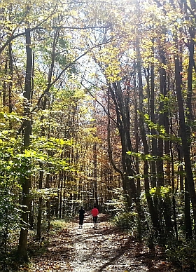
Calling all adventure enthusiasts! We are thrilled to announce the kickoff event of the QOC orienteering season at Lake Accotink Park in Fairfax County. Whether you're a seasoned orienteer or a curious beginner, this event promises to be a fun and challenging experience for all. Come enjoy the rolling hills and fantastically open woods at this special venue.
Lake Accotink is a beautiful park in Springfield, VA with a train trestle, tangled trails, and of course, a sparkling lake. There are numerous mountain bike/hiking trails throughout the park, with new ones (that may not be mapped) appearing periodically. The courses presented will provide a challenge for keeping track of which trails you’ve checked off along your route.
This event features classic/foot orienteering, with an optional mountain bike orienteering (MTBO) course. [Registering only for MTBO is not possible.] All MTBO starts will be between 9:00 - 9:30am, with classic/foot orienteering starting at 10:00am. Orienteers are encouraged to register for both events; the MTBO entry fee is offered at a 50% discount. While groups of up to 4 are allowed as usual on the classic/foot course, bike participants must register either solo or as groups of two (at most). For additional MTBO guidelines and rules, please see below.
What to Expect
Participants will navigate through diverse terrains, including wooded areas, open fields, and waterways, using a map and compass. This event is designed to test your navigation skills, endurance, and for groups, teamwork. Various courses will be available to accommodate all skill levels:- Beginner Course: Perfect for newcomers, offering a gentle introduction to orienteering with straightforward checkpoints and kid-friendly terrain. Beginner Instruction will be available.
- Intermediate Course: A bit more challenging, great for those with some orienteering experience looking to improve their skills.
- Advanced Courses: For experienced orienteers seeking a rigorous and demanding course with complex navigation.
What to Bring
Participants should come prepared with the following items:- Comfortable outdoor clothing and sturdy footwear
- Water bottle and snacks
- Compass and whistle if you have them. Loaners are available if needed.
Parking Details
We will be using the main parking lot, near the end of Accotink Park Rd just below the dam. (7500 Accotink Park Rd., see locator map) QOC signage will point you towards the main parking lot. There is a 400 meter walk to the check-in area at the McClaren-Sargent shelter. The small parking lot near the McLaren-Sargent shelter is reserved for event volunteers.
Groups
QOC allows groups of up to 4 people to orienteer together. Any youth or large groups attending this event should contact the Event Director in advance so that we can coordinate pre-registration for your group. Details and the required waiver form can be found on our For Group Leaders webpage.
Volunteers
We are seeking just a few volunteers to assist with various aspects of the event, including parking/shuttle coordination, check-in, beginner instruction, and control pick up. Your help is invaluable in ensuring a smooth and enjoyable experience for all participants. If you are interested in volunteering, please reach out to the Event Director.
Post–event Social
After your run, head to El Paso Mexican Restaurant, located here, just 3.5 miles from the park. Grab a bite to eat, discuss your run and catch up with friends!Don't miss out on this opportunity to celebrate the start of our new season, explore the natural beauty of Lake Accotink Park, and challenge yourself in a thrilling orienteering adventure. We look forward to seeing you there!
| Volunteers |
|
||||||||||||||||||||||||||||||||||||||||||||||||||
|---|---|---|---|---|---|---|---|---|---|---|---|---|---|---|---|---|---|---|---|---|---|---|---|---|---|---|---|---|---|---|---|---|---|---|---|---|---|---|---|---|---|---|---|---|---|---|---|---|---|---|---|
| Course Details |
|
||||||||||||||||||||||||||||||||||||||||||||||||||
| Course Notes |
Classic/Foot-O Course Notes:
Long pants are recommended; the woods are full of thorns with occasional poison oak. Visibility is good. Use caution on trails as they are used by mountain bikers. There are some unmarked trails between the main E-W trail and the river to the north.
Mountain Biking Notes:
|
||||||||||||||||||||||||||||||||||||||||||||||||||
| Registration | Advance registration will be required. The date and time that registration will open will be posted here; usually, registration will open at 6pm on the Monday before the event. |
||||||||||||||||||||||||||||||||||||||||||||||||||
| Schedule |
|
||||||||||||||||||||||||||||||||||||||||||||||||||
| Location | Lower Lot (for Parking) | ||||||||||||||||||||||||||||||||||||||||||||||||||
| Driving Directions |
From southbound, I-95 Springfield West, first right on Backlick Road. Left on Highland to Park. Park in the lower parking lot below the dam, then walk to the pavilion where registration is located; follow signs or ask someone how to get to the McLaren-Sargent pavilion. From northbound I-95 Springfield West to third stoplight. Right on Hanover, left on Highland (sixth stop sign) to Park. Park in the lower parking lot below the dam; then walk to the McLaren-Sargent pavilion. From I-395, Edsall Road West to end. Left on Braddock Road to third stoplight. Right onto Highland to Park. Park in the lower parking lot below the dam, then walk to the McLaren-Sargent pavilion. (This avoids the Springfield I-95 Interchange which may have a back-up).
|
||||||||||||||||||||||||||||||||||||||||||||||||||
| Entry Fees | Individual Entries Note: juniors = under 21
Group Entries Participants are welcome to orienteer together as a group (up to the maximum for that event; usually 4). Each member of a group is charged their individual rate as shown above, up to a group total of $30 (maximum), and each receives a map. A group receives one epunch. Individuals or groups desiring to compete on a second course after completing their first can do so for a reduced fee of $2/map subject to approval at the event by the Event Director. Important Notes
|
Volunteers
- Event Director : Paul Hession
- Course Designer : Carl Lundgren
- Course Designer : Mark Thomsen
Course Details
| Course Name | Length (km) | Climb (m) | No. Controls | Scale |
|---|---|---|---|---|
| White | 1.5 | 50 | 8 | |
| Yellow | 2.4 | 70 | 10 | |
| Orange | 3.2 | 90 | 9 | |
| Brown | 3.4 | 60 | 8 | |
| Green | 5.1 | 125 | 13 | |
| Red | 6.4 | 185 | 17 | |
| Beginner | 3.1 | 65 | 7 | |
| Intermediate | 4.5 | 105 | 9 | |
| Advanced | 7.2 | 130 | 11 |
Course Notes
Long pants are recommended; the woods are full of thorns with occasional poison oak. Visibility is good. Use caution on trails as they are used by mountain bikers. There are some unmarked trails between the main E-W trail and the river to the north.
Mountain Biking Notes:
MTBO is navigational racing on mountain bikes, in which each participant is given a map showing a series of checkpoints to be found in a designated order in the shortest possible time, with the choice of route between checkpoints left up to the racer. Success therefore depends on raw speed, of course, but also on the ability to read the map, make good route choices and execute them efficiently. NOte that this MTBO event will use the (foot) orienteering map instead of a MTBO map.
Rules for the MTBO event:
- NOTE: The railway bed/track is out of bounds. Stay away from it.
- Helmet use is mandatory.
- Participants are required to stay within 10 feet of their bikes at all times while racing.
- Participants are required to stay on trails, tracks, roads and fields. No short cuts through the forest.
- Be aware that all courses require some degree of technical MTB riding skills and may involve quite narrow, steep and rocky sections.
- Participants must yield to horses and pedestrians, in accordance with park rules. Respect other park users (and their animals) and don't pass in a manner likely to spook or startle anyone.
- Choose a Foot-O start time that allows you enough time to finish your MTBO course.
Registration
Advance registration will be required. The date and time that registration will open will be posted here; usually, registration will open at 6pm on the Monday before the event.
Schedule
-
Sunday, September 7
10:00 am - 3:00 pm
Location
Driving Directions
From southbound, I-95 Springfield West, first right on Backlick Road. Left on Highland to Park. Park in the lower parking lot below the dam, then walk to the pavilion where registration is located; follow signs or ask someone how to get to the McLaren-Sargent pavilion.
From northbound I-95 Springfield West to third stoplight. Right on Hanover, left on Highland (sixth stop sign) to Park. Park in the lower parking lot below the dam; then walk to the McLaren-Sargent pavilion.
From I-395, Edsall Road West to end. Left on Braddock Road to third stoplight. Right onto Highland to Park. Park in the lower parking lot below the dam, then walk to the McLaren-Sargent pavilion. (This avoids the Springfield I-95 Interchange which may have a back-up).
Google Maps Link
Apple/iPhone Link
Entry Fees
Individual Entries
Note: juniors = under 21
| Club Member, adult | Club Member, junior | Non-Member, adult | Non-Member, junior |
|---|---|---|---|
| $10 | $5 | $20 | $5 |
Group Entries
Participants are welcome to orienteer together as a group (up to the maximum for that event; usually 4). Each member of a group is charged their individual rate as shown above, up to a group total of $30 (maximum), and each receives a map. A group receives one epunch. Individuals or groups desiring to compete on a second course after completing their first can do so for a reduced fee of $2/map subject to approval at the event by the Event Director.
Important Notes
- If you wish to become a QOC member you should join online in advance via this webpage (which also explains the member benefits). Membership is completely optional.
- Most of our events use an 'epunch' timing chip for electronic timing. Individuals or groups without their own epunch will be loaned one for that event. Loaned epunches that are lost incur a $40 replacement fee. Epunches (also known as SI-cards or finger sticks) can be purchased from online vendors as described here.
- Former QOC members who have let their membership lapse pay non-member fees.
- Compasses are available at no charge, but if lost incur a $15 replacement fee.
- Please provide collateral (such as car keys) when borrowing a compass or epunch.
- There is no planned, on-site beginner instruction, but beginners are encouraged to watch relevant videos such as this one created by QOC's instructional guru David Onkst



