Primary tabs
Sunday
Add to Calendar
(not available for past events)
 Pre-registration is required and will open Monday, April 27 at 6pm. It will close on Saturday, May 2 at 12 noon.
There will be no day-of registration.
Orienteering at Blockhouse Point
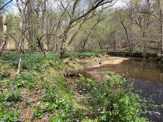
Calling all adventure enthusiasts! We are excited to return to the beautiful Blockhouse Point Park in Potomac, Maryland, after last spring’s debut event there. Whether you’re a seasoned orienteer or a curious beginner, this event promises to be a fun and challenging experience for all. Come enjoy the rolling hills, spring wildflowers, and fantastically open woods at this special venue.
What to Expect
Participants will navigate through diverse terrains, including wooded areas, open fields, and waterways, using a map and compass. This event is designed to test your navigation skills, endurance, and for groups, teamwork. Courses (white through blue; stats below) will be available to accommodate all skill levels:- Beginner Courses (white & yellow): Perfect for newcomers, offering a gentle introduction to orienteering with straightforward checkpoints and kid-friendly terrain.
- Intermediate Course (orange): A bit more challenging, great for those with some orienteering experience looking to improve their skills.
- Advanced Courses (beige to blue): For experienced orienteers seeking a rigorous and demanding course with complex navigation.
What to Bring
Participants should come prepared with the following items:- Comfortable outdoor clothing and sturdy footwear
- Water bottle and snacks
- Compass and whistle if you have them. Loaners are available if needed.
Parking and Check-in Details
Parking is limited at Blockhouse Point, so we have arranged for participants to park at the nearby Bretton Woods Country Club Swimming Pool parking lot 1.5 miles further along River Road from the park. This year, the check-in and download area will be located at the Bretton Woods parking lot, along with porta-potties. Shuttles will carry you to the remote start area for all courses at the park (where the finish area will also be located, to take the shuttle back to Bretton Woods for e-punch download). The ride takes about 4 minutes. Parking at the venue is restricted to event volunteers working there.
 Have a bit of time to help? Join the crew by signing up via this form or email the Event Director for other volunteering opportunities.
Beginners
Make sure to check out our Your First Event and For Beginners webpages, and if they don't answer all your questions, just ask them via our Contact Form. We will also offer beginner instruction at the event.
Groups
QOC allows groups of up to 4 people to orienteer together. Any youth or large groups attending this event should contact the Event Director in advance so that we can coordinate pre-registration for your group. Details and the required waiver form can be found on our For Group Leaders webpage.
Post-Event
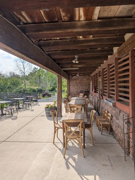
A short 5 minute drive here will bring you to the Rocklands Farm Winery, open on Sundays from 12 - 6pm and said to be the top rated winery in the DC area, with both plenty of outdoor and indoor seating. We encourage you to have a picnic here - you are welcome to bring your own food and non-alcoholic beverages. Wine and pizzas can be purchased.
Advance Notice!
Non-citizen orienteers without permanent resident status in the US must contact our May 16 event director before May 11 to discuss access to our event on the Quantico Marine Corps Base (details here).| Volunteers |
|
|||||||||||||||||||||||||||||||||||||||||||||
|---|---|---|---|---|---|---|---|---|---|---|---|---|---|---|---|---|---|---|---|---|---|---|---|---|---|---|---|---|---|---|---|---|---|---|---|---|---|---|---|---|---|---|---|---|---|---|
| Course Details |
|
|||||||||||||||||||||||||||||||||||||||||||||
| Course Notes |
Welcome to our second full event at Blockhouse! It's a fine park with both history (Civil War sites) and "white" woods at most times of year.
Logistics: Take the shuttle bus from our Bretton Woods reg/parking area to the (small) parking lot at Blockhouse Point - do not park there! There are two start locations: the white, yellow, orange and beige courses will start near the southwest edge of the parking lot, while orienteers on the other courses will need to carefully cross the road to their start. All orienteers finish at the same location (near the parking lot), and will then take the shuttle bus back to the Bretton Woods parking lot. There will be at least one porta-pot at both parking lots.
Map & Terrain: Mapped quite accurately by Nadim Ahmed, Blockhouse Point terrain features mostly open hardwood forests with both small and large ditches, gullies and re-entrants. Point features are often (small!) knolls, pits or rocks; rootstocks, on the other hand, can be large.
Course Info: This is not a very technical terrain, due to the trails and other dominant linear features. The steepness of the terrain, however, dictates careful route choice. On trails, don't be surprised to come across equestrians and mountain bikers. Course Map Scales: White, yellow, orange, beige and brown course maps will be printed at 1:7500 scale; all other courses will be 1:10,000. [Note: all are letter size except brown, which will be on legal paper.] |
|||||||||||||||||||||||||||||||||||||||||||||
| Registration | Advance registration will be required. The date and time that registration will open will be posted here; usually, registration will open at 6pm on the Monday before the event. |
|||||||||||||||||||||||||||||||||||||||||||||
| Schedule |
|
|||||||||||||||||||||||||||||||||||||||||||||
| Location | Blockhouse Point, Bretton Woods Pool Parking, Darnestown, Maryland | |||||||||||||||||||||||||||||||||||||||||||||
| Driving Directions |
Blockhouse Point, Bretton Woods Pool Parking, Darnestown, Maryland
Google Maps Link Apple/iPhone Link
Approaching from the northeast (ex: Gaithersburg) take Darnestown Rd/Rt 28 and then Seneca Rd/Rt 112. At the River Road intersection, turn left and then in just ~100 meters turn right to enter Bretton Woods. Follow signs to the Bretton Woods Pool House parking.
Approaching from the southeast (ex: American Legion Bridge or Bethesda) drive northwest on River Rd/Rt 190 until just before it ends at Seneca Rd/Rt 112. ~100 meters before then, turn left to enter Bretton Woods. Follow signs to the Bretton Woods Pool House parking. |
|||||||||||||||||||||||||||||||||||||||||||||
| Entry Fees | Individual Entries Note: juniors = under 21
Group Entries Participants are welcome to orienteer together as a group (up to the maximum for that event; usually 4). Each member of a group is charged their individual rate as shown above, up to a group total of $30 (maximum), and each receives a map. A group receives one epunch. Individuals or groups desiring to compete on a second course after completing their first can do so for a reduced fee of $2/map subject to approval at the event by the Event Director. Important Notes
|
Volunteers
- Course Designer : Greg Lennon
- Course Designer : Kathleen Lennon
- Event Director : Massey Bartolini
Course Details
| Course Name | Length (km) | Climb (m) | No. Controls | Scale |
|---|---|---|---|---|
| White | 1.9 | 70 | 7 | |
| Yellow | 2.3 | 75 | 8 | |
| Orange | 3.6 | 135 | 13 | |
| Beige | 3.3 | 120 | 8 | |
| Brown | 4.1 | 210 | 8 | |
| Green | 5.2 | 285 | 12 | |
| Red | 6.9 | 325 | 15 | |
| Blue | 7.7 | 345 | 17 |
Course Notes
Logistics: Take the shuttle bus from our Bretton Woods reg/parking area to the (small) parking lot at Blockhouse Point - do not park there! There are two start locations: the white, yellow, orange and beige courses will start near the southwest edge of the parking lot, while orienteers on the other courses will need to carefully cross the road to their start. All orienteers finish at the same location (near the parking lot), and will then take the shuttle bus back to the Bretton Woods parking lot. There will be at least one porta-pot at both parking lots.
Map & Terrain: Mapped quite accurately by Nadim Ahmed, Blockhouse Point terrain features mostly open hardwood forests with both small and large ditches, gullies and re-entrants. Point features are often (small!) knolls, pits or rocks; rootstocks, on the other hand, can be large.
Hazards include fence wiring (only some of which has been streamered for this event) and uncrossable cliffs and earthbanks (mapped as such).
Course Info: This is not a very technical terrain, due to the trails and other dominant linear features. The steepness of the terrain, however, dictates careful route choice. On trails, don't be surprised to come across equestrians and mountain bikers.
White & Yellow: Trail based; pay attention to orientation and distance(s) and you'll be fine. A section of trail on the Yellow course is steep and has some small/loose rock.
Orange: Taking bearings and using linear features is essential, along with using collecting and catching features. Make sure you are ready for off-trail orienteering.
Beige: longer legs will allow more route choice.
Brown, Green, Red and Blue: Do not cross olive green (private) areas. You will cross Muddy Branch Creek (and get wet feet at a minimum), optimally at crossings marked on the map. To cross from the north side of the map to the south, you are strongly encouraged to use the underpass just south of the control near it. [In the unlikely event the creek water level is unusually high, a course adjustment will be made.]
Course Map Scales: White, yellow, orange, beige and brown course maps will be printed at 1:7500 scale; all other courses will be 1:10,000. [Note: all are letter size except brown, which will be on legal paper.]
Registration
Advance registration will be required. The date and time that registration will open will be posted here; usually, registration will open at 6pm on the Monday before the event.
Schedule
-
Sunday, May 3
10:00 am - 3:00 pm
Location
Driving Directions
Google Maps Link
Apple/iPhone Link
Approaching from the southeast (ex: American Legion Bridge or Bethesda) drive northwest on River Rd/Rt 190 until just before it ends at Seneca Rd/Rt 112. ~100 meters before then, turn left to enter Bretton Woods. Follow signs to the Bretton Woods Pool House parking.
Entry Fees
Individual Entries
Note: juniors = under 21
| Club Member, adult | Club Member, junior | Non-Member, adult | Non-Member, junior |
|---|---|---|---|
| $10 | $5 | $20 | $5 |
Group Entries
Participants are welcome to orienteer together as a group (up to the maximum for that event; usually 4). Each member of a group is charged their individual rate as shown above, up to a group total of $30 (maximum), and each receives a map. A group receives one epunch. Individuals or groups desiring to compete on a second course after completing their first can do so for a reduced fee of $2/map subject to approval at the event by the Event Director.
Important Notes
- If you wish to become a QOC member you should join online in advance via this webpage (which also explains the member benefits). Membership is completely optional.
- Most of our events use an 'epunch' timing chip for electronic timing. Individuals or groups without their own epunch will be loaned one for that event. Loaned epunches that are lost incur a $40 replacement fee. Epunches (also known as SI-cards or finger sticks) can be purchased from online vendors as described here.
- Former QOC members who have let their membership lapse pay non-member fees.
- Compasses are available at no charge, but if lost incur a $15 replacement fee.
- Please provide collateral (such as car keys) when borrowing a compass or epunch.
- Beginners are encouraged to watch relevant videos such as this one created by QOC's instructional guru David Onkst



