Primary tabs
Saturday
Add to Calendar
(not available for past events)
 Pre-registration is required and will open on Monday, May 12 at 6pm and will close at noon **Friday** May 16. There will be no day-of registration.
Orienteering at Upper Marlboro Natural Area
Join Us for an Exciting Family Adventure!
Quantico Orienteering Club returns to the Upper Marlboro Natural Area for this Saturday event. With about 900 acres along the western shore of the Patuxent River, it provides a mix of mid- Atlantic spur and reentrant terrain with Patuxent River lowlands.
What to Expect
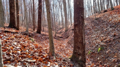
Participants will navigate through diverse terrains, including wooded areas, open fields, and waterways, using a map and compass. This event is designed to test your navigation skills, endurance, and for groups, teamwork. Various courses will be available to accommodate all skill levels:- Beginner Courses (white & yellow): Perfect for newcomers, offering a gentle introduction to orienteering with straightforward checkpoints and kid-friendly terrain. Beginner Instruction will be available.
- Intermediate Course (orange): A bit more challenging, great for those with some orienteering experience looking to improve their skills.
- Advanced Courses (brown, green, red & blue): For experienced orienteers seeking a rigorous and demanding course with complex navigation.
What to Bring
Participants should come prepared with the following items:- Comfortable outdoor clothing and sturdy footwear
- Water bottle and snacks
- Compass and whistle if you have them. Loaners are available if needed.
Groups
QOC allows groups of up to 4 people to orienteer together. Any youth or large groups attending this event should contact the Event Director in advance so that we can coordinate pre-registration for your group. Details and the required waiver form can be found on our For Group Leaders webpage.
 Volunteer: Sign up for a volunteer slot via this form, or email the Event Director directly for other options.
Take advantage of this exciting opportunity to navigate the diverse landscapes of the Upper Marlboro Natural Area and test your skills in an exhilarating orienteering challenge.
Post-Event Social: After your adventure, join fellow orienteers at Panera, located here, 8 miles north of the park.
Happy orienteering!
| Volunteers |
|
||||||||||||||||||||||||||||||||||||||||
|---|---|---|---|---|---|---|---|---|---|---|---|---|---|---|---|---|---|---|---|---|---|---|---|---|---|---|---|---|---|---|---|---|---|---|---|---|---|---|---|---|---|
| Course Details |
|
||||||||||||||||||||||||||||||||||||||||
| Course Notes |
Welcome to the 2025 Swanson Road event! The undergrowth has come up since I planned the courses a month ago, but it's still very pleasant running. A few cautions:
There isn't a lot of dark green on the map, but if you come across, it, try to avoid it. It's multiflora rose and other spiky plants. Some of the marked paths on the map can be hard to see in the forest. They may disappear and appear again. The rivers and streams often have very tall, steep banks, and you might find easier ways across if you look for them. The model airplane airfield may be active during the event. The courses all stay away from it, and there's no reason for you to be there, unless you want to watch the planes. There are red boundary lines on the north and west sides of the map. Those lines mark private property, and you must not cross them. This will not be a problem except on the Orange and Blue courses. On the Orange course, your Control 2 is close to the red line. Stay near the deep reentrant, where the control will be. On the Blue course, the leg from 12 to 13 is bent so it does not cross the out-of-bounds area. Follow that line instead of going straight. |
||||||||||||||||||||||||||||||||||||||||
| Registration | Advance registration is required. Registration for this event will open at 6pm on Monday May 12 and will close as 12 noon on *Friday* May 16 (the day before the event).
Who's Registered? Check by clicking here. |
||||||||||||||||||||||||||||||||||||||||
| Schedule |
|
||||||||||||||||||||||||||||||||||||||||
| Location | Swanson Road Natural Area, North end, Upper Marlboro, Maryland | ||||||||||||||||||||||||||||||||||||||||
| Driving Directions |
From the Washington Beltway, take exit 11 to MD-4 South/Pennsylvania Avenue. After 8 miles, exit onto US-301 North. Drive 3 miles then turn right onto Swanson Road. Stay on Swanson Road for about half a mile, then instead of turning right for Swanson Road, continue straight onto Swanson Road Spur. Follow Swanson Road Spur for another half mile+ to the parking area.
If your route brings you south on US-301, turn left onto Swanson Road - it's the next junction south of Leeland Road, with the right turn being onto Beech Tree Parkway and the left turn, crossing the highway onto Swanson Road, then follow directions above.
|
||||||||||||||||||||||||||||||||||||||||
| Entry Fees | Individual Entries
Note: juniors = under 21
Group Entries Participants are welcome to orienteer together as a group (up to the maximum for that event; usually 4). Each member of a group is charged their individual rate as shown above, up to a group total of $30 (maximum), and each receives a map. A group receives one epunch. Individuals or groups desiring to compete on a second course after completing their first can do so for a reduced fee of $2/map subject to approval at the event by the Event Director. Important Notes
|
Volunteers
- Course Designer : Tom Nolan
- Event Director : Reiko Rager
- Event Director : Massey Bartolini
Course Details
| Course Name | Length (km) | Climb (m) | No. Controls | Scale |
|---|---|---|---|---|
| White | 1.4 | 10 | 8 | |
| Yellow | 2.1 | 25 | 9 | |
| Orange | 3.6 | 95 | 10 | |
| Brown | 4.6 | 155 | 9 | |
| Green | 5.8 | 180 | 13 | |
| Red | 7.1 | 200 | 14 | |
| Blue | 8.2 | 235 | 16 |
Course Notes
There isn't a lot of dark green on the map, but if you come across, it, try to avoid it. It's multiflora rose and other spiky plants.
Some of the marked paths on the map can be hard to see in the forest. They may disappear and appear again.
The rivers and streams often have very tall, steep banks, and you might find easier ways across if you look for them.
The model airplane airfield may be active during the event. The courses all stay away from it, and there's no reason for you to be there, unless you want to watch the planes.
There are red boundary lines on the north and west sides of the map. Those lines mark private property, and you must not cross them. This will not be a problem except on the Orange and Blue courses. On the Orange course, your Control 2 is close to the red line. Stay near the deep reentrant, where the control will be. On the Blue course, the leg from 12 to 13 is bent so it does not cross the out-of-bounds area. Follow that line instead of going straight.
Registration
Advance registration is required. Registration for this event will open at 6pm on Monday May 12 and will close as 12 noon on *Friday* May 16 (the day before the event).
 .
.
Who's Registered? Check by clicking here.
Schedule
-
Saturday, May 17
10:00 am - 3:00 pm
Location
Driving Directions
If your route brings you south on US-301, turn left onto Swanson Road - it's the next junction south of Leeland Road, with the right turn being onto Beech Tree Parkway and the left turn, crossing the highway onto Swanson Road, then follow directions above.
Entry Fees
Individual Entries
Note: juniors = under 21
| Club Member, adult | Club Member, junior | Non-Member, adult | Non-Member, junior |
|---|---|---|---|
| $10 | $5 | $20 | $5 |
Group Entries
Participants are welcome to orienteer together as a group (up to the maximum for that event; usually 4). Each member of a group is charged their individual rate as shown above, up to a group total of $30 (maximum), and each receives a map. A group receives one epunch. Individuals or groups desiring to compete on a second course after completing their first can do so for a reduced fee of $2/map subject to approval at the event by the Event Director.
Important Notes- If you wish to become a QOC member you should join online in advance via this webpage (which also explains the member benefits). Membership is completely optional.
- Most of our events use an 'epunch' timing chip for electronic timing. Individuals or groups without their own epunch will be loaned one for that event. Loaned epunches that are lost incur a $40 replacement fee. Epunches (also known as SI-cards or finger sticks) can be purchased from online vendors as described here.
- Former QOC members who have let their membership lapse pay non-member fees.
- Compasses are available at no charge, but if lost incur a $15 replacement fee.
- Please provide collateral (such as car keys) when borrowing a compass or epunch.
- There is no planned, on-site beginner instruction, but beginners are encouraged to watch relevant videos such as this one created by QOC's instructional guru David Onkst



