Patapsco Granite
April 6
Saturday

Yes, we are a GO for this event!
Welcome back to Patapsco Granite! QOC has rescheduled this event to make up for a cancellation earlier in the season. We will offer classic beginner, intermediate, and advanced courses (White to Blue).
Special Note for This Event: Courses will close at 2pm; head out on your course early enough to be back by then please!
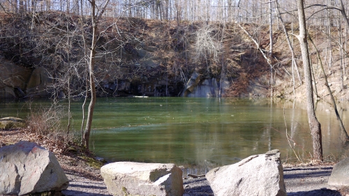
The Granite area provides an excellent opportunity to practice navigation in highly technical and rocky terrain, which is rare for the Mid-Atlantic region. Course details and setter comments are now posted below. Please note this is a Saturday event.
Important: Patapsco Valley State Park has a strict rain policy. Please check here if rain has fallen in the preceding 24 hours to ensure the event is on as scheduled. It hasn't, so this event is on!
![]() Volunteers: Have time to pick up some controls? Sign up via this form, or email the Event Director directly for other options.
Volunteers: Have time to pick up some controls? Sign up via this form, or email the Event Director directly for other options.
Post-event Social: After your run, grab a bite with fellow orienteers at Peri Peri Original, located here just 8 miles southeast of our event.
Back By Popular Demand - Jersey Orders: Come check out the custom QOC jerseys and confirm your preferred size and style! We'll have them on display at this event from ~10:30am - 12pm. Orders must be placed before April 22; details are here.

| Location | Patapsco Valley State Park, Granite Area, Woodstock, MD (Classic) | ||||||||||||||||||||||||||||||||||||
| Registration | Registration will open at 6pm on Monday April 1 and close at 12 noon on *Friday* April 5 (the day before the event). Pre-registration is mandatory. Who's Registered? Check by clicking here. | ||||||||||||||||||||||||||||||||||||
| Start Times | Start times will be by windows (to be defined for this event before registration opens). | ||||||||||||||||||||||||||||||||||||
| Schedule | Saturday, April 6
| ||||||||||||||||||||||||||||||||||||
| Volunteers |
| ||||||||||||||||||||||||||||||||||||
| Location Details |
| ||||||||||||||||||||||||||||||||||||
| Course Details | Classic
| ||||||||||||||||||||||||||||||||||||
| Course Notes | Classic Course notes: Courses will close at 2pm - make sure to be back by then. All Courses: Make sure to check control codes! In several locations on most courses, there are groups of controls quite close to each other, and only one of them will be the one on your course - so double-check the number to confirm it's the right one! Both the White and Yellow courses have a streamered leg (from the last control to the finish) due to the absence of a path back home from the last control. The streamers consist of 1-foot long bright plastic tape that the runners can follow around some brush and then in an approximately straight line through the woods towards the last control. The open grassy field in the start area will be visible off to the right of the runners, and the woods are not dense, so there should be no need to worry about getting back home. The White course (map scale is 1:5000) has a few short legs that are not on a path (the last couple of legs), but these occur in open areas, and should not represent major navigational challenges. The Yellow course (map scale 1:5000) has a few legs that follow linear features through the terrain, as well as a couple of opportunities to try a short compass bearing through the woods to save distance if desired. Note that one short leg has no option to follow a linear feature, but for this leg, the target control will be hung high and visible from a ‘safe’ location. Think before you run (always a good plan), and you will be fine.
Advanced courses: The highly invasive weed Wavy Leaf Basketgrass has spread over much of the park; at the time of writing (mid-March), the weed is still dormant, and it should not be a problem at the time of the meet. The seeds are sticky and you may find some that stick to shoes and garments. PLEASE make every effort to remove them before leaving the park to avoid spreading the plant to other areas. Map notes from Ted Good: 1:10,000 5 meter contours. Up to date symbol set.
Trails:
Vegetation/terrain:
Rocks:
Man-made features: | ||||||||||||||||||||||||||||||||||||
| Entry Fees | Individual Entries
Note: juniors = under 21
Group Entries Participants are welcome to orienteer together as a group (up to the maximum for that event; usually 4). Each member of a group is charged their individual rate as shown above, up to a group total of $30 (maximum), and each receives a map. A group receives one epunch. Individuals or groups desiring to compete on a second course after completing their first can do so for a reduced fee of $2/map subject to approval at the event by the Event Director. Important Notes
|
