Primary tabs
Saturday
Add to Calendar
(not available for past events)
 Pre-registration for this *Saturday* event is required and will open on Monday, Oct. 10 at 6pm and close at noon on Friday Oct. 14.
There will not be day-of registration.
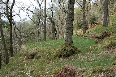
Welcome back to Cunningham Falls for the sixth edition of Platformpalooza, which is "an orienteering celebration of that rare in our area but nevertheless humble remnant of the era before fossil fuel dominance, the charcoal platform" (a grassier than usual for this event Scottish examplar of this trace of human impact on the landscape is pictured to the right). Course stats and comments are provided below.
The park charges a per vehicle entry fee - $3 for MD residents, $5 for out-of-staters. If a ranger states the park is too crowded to enter and tries to turn you away at the gate, since we have a permitted event, please tell the ranger on duty you are attending our event in order to be let in.
Cunningham Falls is more rugged than many of our other venues, and as a precaution, QOC has again partnered with Maryland and Mid-Atlantic Wilderness Rescue Squad to provide on-site first response in the event of participant injury. The on-site responders will almost certainly arrive faster than calls placed to 911, so, unlike other QOC events, call the Rescue Squad first if there’s a serious injury.
We also plan to offer MapRun versions of the courses, and participants are encouraged to use that app while out on their courses.
Check in will open about 9:45am and courses will open at 10:00am.
As always, please be off the course no later than 3 pm and remember to download at our e-punch station even if you did not finish. We want to make sure of everyone’s safety and status.
Free Beginner Instruction will be offered, but please reach out to the Event Director if you have a group, so we can plan accordingly. Also, make sure to check out our Your First Event and For Beginners webpages, and if they don’t answer any remaining questions you have, just use our Contact Form and ask away!
Group Leaders: Please see our For Group Leaders page if you are leading a youth or large group – even though you will be pre-registering online. Please contact the Event Director with your plans and numbers for her awareness.
Other notes:
- Pets are allowed in Cunningham Falls Park.
- Advanced courses have ~600m uphill walk to the start, so plan your start window accordingly.
- The campground is out of bounds.
- QOC will continue to use pre-registration as the ONLY method of signing up for our meets. There will be NO day-of, on-site registration. Refunds are paid only in the case of event cancellation.
- Masks are optional at all locations connected with the event. Please continue to minimize clustering at and around the check-in, e-punch, start and finish areas.
- As mentioned above, beginner instruction has resumed to provide an overview of orienteering basics for newcomers to the sport or those who just want a refresher.
- There is no water on the course. Participants are responsible for their own hydration. A very limited supply of bottled water for emergency use will be on hand with the Meet Director; but it is vital to stay well hydrated. Please come prepared!
- There are no snacks offered by QOC.
- The park charges an entrance fee: Maryland residents $3/person; out-of-state residents $5/person.
- For this event (as with most others this season) there will be eight 15 minute check-in windows followed by two 45min windows.
| Volunteers |
|
||||||||||||||||||||||||||||||||||||||||
|---|---|---|---|---|---|---|---|---|---|---|---|---|---|---|---|---|---|---|---|---|---|---|---|---|---|---|---|---|---|---|---|---|---|---|---|---|---|---|---|---|---|
| Course Details |
|
||||||||||||||||||||||||||||||||||||||||
| Course Notes |
The map does not have the level of detail that most of our maps do. There may be boulders and rootstocks that are not mapped, but the ones that competitors are most likely to see should be mapped. I tried to add some updates, but the flatter area near the highway is barely field checked, so there’s a lot of detail missing that you would usually expect to be on maps. There will still be features that you come across that are not mapped. Some mapped vegetation is based on field checking, but most is still based on LIDAR data.
DO NOT go into the campground area!! It’s marked out of bounds on the map, so do NOT go into it!! It’s not recommended to try to move up a course at this event- the distances might be shorter but that’s because the terrain is extremely technical and can be pretty physical: the map is essentially a large hillside, and there are a lot of rocks and deadfall on the ground making it difficult to safely move fast. Advanced courses will have ~ 600 m walk uphill to their start. Emergency services volunteers will be stationed on the mountain near two separate locations marked on the map. There are controls near both locations and emergency personnel will be located near those controls. Participants are encouraged to carry a cell phone. The telephone number to call in case of an emergency will be printed on each course map. |
||||||||||||||||||||||||||||||||||||||||
| Registration | Registration for this event will open at 6pm on Monday Oct. 10 via this link. Registration will close at noon on Friday, Oct. 14. Pre-registration is mandatory. Who's registered? Check by clicking here. Sorting by column is possible too - just click on the column name. |
||||||||||||||||||||||||||||||||||||||||
| Schedule |
|
||||||||||||||||||||||||||||||||||||||||
| Location | Cunningham Falls St. Park, Manor Area, Thurmont, Maryland | ||||||||||||||||||||||||||||||||||||||||
| Driving Directions |
From US-15, 11 miles north of Frederick MD and 2.7 miles south of Thurmont, turn west onto Cunningham Falls Park Rd. After entering the park, keep following the road around to your left, past the parking lots, playground, visitor center and aviary, then park in the large parking lot at the bottom of the incline south of the aviary. Registration will be in the pavilion near the northeast corner of that parking lot. |
||||||||||||||||||||||||||||||||||||||||
| Entry Fees | Individual Entries
Note: juniors = under 21
Group Entries Participants are welcome to orienteer together as a group (up to the maximum for that event; usually 4). Each member of a group is charged their individual rate as shown above, up to a group total of $30 (maximum), and each receives a map. A group receives one epunch. Individuals or groups desiring to compete on a second course after completing their first can do so for a reduced fee of $2/map subject to approval at the event by the Event Director. Important Notes
|
Course Details
| Course Name | Length (km) | Climb (m) | No. Controls | Scale |
|---|---|---|---|---|
| White | 1.4 | 85 | 6 | |
| Yellow | 1.9 | 125 | 7 | |
| Orange | 3.9 | 175 | 10 | |
| Brown | 3.2 | 115 | 12 | |
| Green | 4.7 | 225 | 12 | |
| Red | 5.7 | 230 | 15 | |
| Blue | 6.8 | 300 | 20 |
Course Notes
DO NOT go into the campground area!! It’s marked out of bounds on the map, so do NOT go into it!!
It’s not recommended to try to move up a course at this event- the distances might be shorter but that’s because the terrain is extremely technical and can be pretty physical: the map is essentially a large hillside, and there are a lot of rocks and deadfall on the ground making it difficult to safely move fast.
Advanced courses will have ~ 600 m walk uphill to their start.
Emergency services volunteers will be stationed on the mountain near two separate locations marked on the map. There are controls near both locations and emergency personnel will be located near those controls. Participants are encouraged to carry a cell phone. The telephone number to call in case of an emergency will be printed on each course map.
Registration
Registration for this event will open at 6pm on Monday Oct. 10 via this link. Registration will close at noon on Friday, Oct. 14. Pre-registration is mandatory.
Who's registered? Check by clicking here. Sorting by column is possible too - just click on the column name.
Schedule
-
Saturday, October 15
10:00 am - 3:00 pm
Location
Driving Directions
From US-15, 11 miles north of Frederick MD and 2.7 miles south of Thurmont, turn west onto Cunningham Falls Park Rd. After entering the park, keep following the road around to your left, past the parking lots, playground, visitor center and aviary, then park in the large parking lot at the bottom of the incline south of the aviary. Registration will be in the pavilion near the northeast corner of that parking lot.
Entry Fees
Individual Entries
Note: juniors = under 21
| Club Member, adult | Club Member, junior | Non-Member, adult | Non-Member, junior |
|---|---|---|---|
| $10 | $5 | $20 | $5 |
Group Entries
Participants are welcome to orienteer together as a group (up to the maximum for that event; usually 4). Each member of a group is charged their individual rate as shown above, up to a group total of $30 (maximum), and each receives a map. A group receives one epunch. Individuals or groups desiring to compete on a second course after completing their first can do so for a reduced fee of $2/map subject to approval at the event by the Event Director.
Important Notes- If you wish to become a QOC member you should join online in advance via this webpage (which also explains the member benefits). Membership is completely optional.
- Most of our events use an 'epunch' timing chip for electronic timing. Individuals or groups without their own epunch will be loaned one for that event. Loaned epunches that are lost incur a $40 replacement fee. Epunches (also known as SI-cards or finger sticks) can be purchased from online vendors as described here.
- Former QOC members who have let their membership lapse pay non-member fees.
- Compasses are available at no charge, but if lost incur a $15 replacement fee.
- Please provide collateral (such as car keys) when borrowing a compass or epunch.
- In addition to free on-site beginner instruction if needed, beginners are encouraged to watch relevant videos such as this one created by QOC's instructional guru David Onkst



