Primary tabs
Sunday
Add to Calendar
(not available for past events)
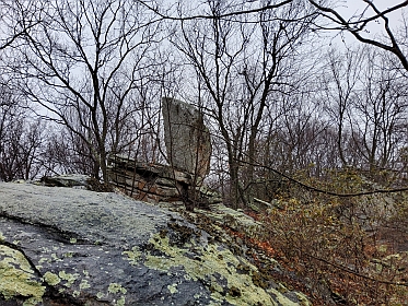
Pre-registration was required and is now closed. There is no day-of registration.
Welcome to QOC's Rogaine, taking place in Maryland's Gambrill State Park and the Frederick Municipal Forest! This year we will have two options - a shorter 3-hour rogaine, with 22 checkpoints, and a longer 8-hour event with 38 checkpoints. E-punching will be used, and full-size flags (controls/checkpoints) will be used. All checkpoints are worth from 1 to 5 points depending on factors such as difficulty to find, or frankly, the whims of course designer Michael Dickey. There is no set course, so it is up to each competitor to determine the best route to get the maximum number of points within the allotted time. Scoring will be based on total points with time used as a tie-breaker. Competitors exceeding the time limit for their course will lose 1 point per minute or fraction of a minute over the time limit for their course. So don’t be late!
While this is not an event suitable for beginning orienteers, all others should find this a challenging and fun event. The 3-hour event is designed to be easier and more friendly to those interested in trying out something new. If you are comfortable with Orange courses, and would enjoy a nice hike in some beautiful terrain, come try this! Want to learn more about rogaines in general? Click here. Note that in contrast to orienteering (where you shouldn't look at your map before you start), in rogaines you are given time to study the map and plan a route before your time starts. For this event, maps will be distributed 30 minutes before event start times.
Post-Event Picnic! Plan to stay around after the event to compare route choices and enjoy complimentary hot dogs, hamburgers, veggie burgers, chips, and soft drinks. Other than alcohol (prohibited in Maryland state parks), feel free to bring anything else you'd like to drink or eat.
Registration Details:
- 3-hour: Registration is currently capped at 75 starts (individuals and teams); cost is $12.49/pp for members, and $22.49 for non-members.
- 8-hour: Registration is currently capped at 50 starts (individuals and teams); cost is $22.49/pp for members, and $32.49 for non-members.
- Registration will open at 6pm on Monday Feb. 26 and will close when sold out or no later than Saturday March 23 at noon.
- Solo rogainers and teams of 2 to 4 (max) are welcome. Note that IRF rules require those under 14 be on a team with at least one person over 18.
- Restrooms will be available near the registration pavilion.
- Dogs are allowed but must be on leash at all times. Both courses have some tough, rocky terrain, so this may not be the best event to bring a dog.
- Recommended Equipment: whistle, watch (make sure to keep track of your time!), compass and basic first aid kit. Phones are allowed but are not to be used for navigation. [Feel free to take photos to share later though!]
- Competitors should bring sufficient hydration (and food) for length of the event, or the means to filter purified water from streams. There is no provided water on the course.
| Volunteers |
|
|||||||||||||||
|---|---|---|---|---|---|---|---|---|---|---|---|---|---|---|---|---|
| Course Details |
|
|||||||||||||||
| Course Notes |
About the Map:
The map is based on recent LIDAR data. It lacks the level of detail and field checking of our orienteering maps, but has more detail than most Rogaine maps and has been improved substantially since last year! Trails and rides are generally accurate. The mapped vegetation is mostly based on LIDAR and has not been thoroughly field checked, but generally it's accurate enough to be helpful. Most light green on the map is mountain laurel that isn’t too difficult to travel through. As usual, contours are the most reliable map feature. Michael has mapped rock features that he's come across but has most definitely NOT mapped all of them. If mapped it’s there, but the absence of rock on the map does not mean it's rock-free! Mapped streams are generally reliable and should be fine for filtering if you need water on the course. There are also a few springs on the map suitable for filling large containers from (they are on the map as well as on Google maps). Private property, including some in the middle of the map is denoted in olive green. Do your best to avoid those areas. Some boundaries are marked on trees but not all of them are. The map scale for the course will be 1:15,000 and the contour interval is 5m. The 3-hour course is on a single 8.5x14 map, and the 8-hour course will have 2 maps (11x17 and 8.5x11), oriented to magnetic north. Clues and point values for each control will be printed on the maps. Maps will not be bagged as in our normal orienteering events so that you can make route notations and notes on the map. Plastic map cases should be available. New This Year! In addition to the improvements mentioned above, the map has been extended to the north of Mountaindale and Fishing Creek roads. About the Course: This is a popular mountain biking area, so be aware that there may be bikes on the trails. Please get off the trail and let them by if you are traveling on trails and see mountain bikers. For LiveLox or other (non-navigational!) use, note that cellphone coverage is decent - towers are on the top of the ridge. 3-hour: the total distance to reach all 22 controls is estimated to be around 16km. 8-hour: the course has 38 controls and competitors will travel around 32km to reach all of them. 8-hour competitors are likely to cross Hamburg Rd twice. Placing a stash (food, water, etc) is not recommended though since crossing points will depend on route selection and putting stuff in the wrong spot will cost a lot of time. There are roads on the map marked as out of bounds for travel. Both Gambril Park Road which you will arrive on, and Hamburg road towards the east side of the map can have substantial fast-moving vehicle traffic and no shoulder. Crossing is OK, but please be careful, and do not travel on the roads. For both courses, since the start/finish area is at the southern edge of the mapped area, looping back mid-course to access any food or water left at the pavilion will not make sense. Participants should plan to carry everything they will need with them for the duration of their course. |
|||||||||||||||
| Registration | Registration is now closed. Pre-registration was mandatory. Who's Registered? Check by clicking here. |
|||||||||||||||
| Schedule |
|
|||||||||||||||
| Location | Gambrill SP, Shelter 3, Frederick, Maryland | |||||||||||||||
| Driving Directions |
Gambrill SP Day-use fee: Maryland residents $3/vehicle; out-of-state residents $5/vehicle. Having exact change ready is recommended, and carpooling is encouraged!
From Washington: Take I-270 north to Frederick, which transitions into U.S. Route 15, and continue to Route 40 west (West Patrick Street). Exit to the I-70 west/Route 40 split, bear right and continue on Route 40. Turn right on Gambrill Park Road. At the High Knob Scenic Area sign, where the road goes right, go left to the parking areas for Shelter 3 as well as Shelter 2 and the Tea Room.
From Baltimore: Take I-70 west to Frederick and follow to U.S. Route 15 and then to Route 40 west exit. Follow Route 40 west to Gambrill Park Road on your right as above. |
|||||||||||||||
| Entry Fees | Special Event Pricing applies to this event - see details above.
Important Notes
|
Course Details
| Course Name | Length (km) | Climb (m) | No. Controls | Scale |
|---|---|---|---|---|
| 3 Hour | 16 | 22 | ||
| 8 Hour | 32 | 38 |
Course Notes
The map is based on recent LIDAR data. It lacks the level of detail and field checking of our orienteering maps, but has more detail than most Rogaine maps and has been improved substantially since last year! Trails and rides are generally accurate. The mapped vegetation is mostly based on LIDAR and has not been thoroughly field checked, but generally it's accurate enough to be helpful. Most light green on the map is mountain laurel that isn’t too difficult to travel through. As usual, contours are the most reliable map feature. Michael has mapped rock features that he's come across but has most definitely NOT mapped all of them. If mapped it’s there, but the absence of rock on the map does not mean it's rock-free!
Mapped streams are generally reliable and should be fine for filtering if you need water on the course. There are also a few springs on the map suitable for filling large containers from (they are on the map as well as on Google maps).
Private property, including some in the middle of the map is denoted in olive green. Do your best to avoid those areas. Some boundaries are marked on trees but not all of them are.
The map scale for the course will be 1:15,000 and the contour interval is 5m. The 3-hour course is on a single 8.5x14 map, and the 8-hour course will have 2 maps (11x17 and 8.5x11), oriented to magnetic north. Clues and point values for each control will be printed on the maps. Maps will not be bagged as in our normal orienteering events so that you can make route notations and notes on the map. Plastic map cases should be available.
New This Year! In addition to the improvements mentioned above, the map has been extended to the north of Mountaindale and Fishing Creek roads.
About the Course:
This is a popular mountain biking area, so be aware that there may be bikes on the trails. Please get off the trail and let them by if you are traveling on trails and see mountain bikers.
For LiveLox or other (non-navigational!) use, note that cellphone coverage is decent - towers are on the top of the ridge.
3-hour: the total distance to reach all 22 controls is estimated to be around 16km.
8-hour: the course has 38 controls and competitors will travel around 32km to reach all of them. 8-hour competitors are likely to cross Hamburg Rd twice. Placing a stash (food, water, etc) is not recommended though since crossing points will depend on route selection and putting stuff in the wrong spot will cost a lot of time.
There are roads on the map marked as out of bounds for travel. Both Gambril Park Road which you will arrive on, and Hamburg road towards the east side of the map can have substantial fast-moving vehicle traffic and no shoulder. Crossing is OK, but please be careful, and do not travel on the roads.
For both courses, since the start/finish area is at the southern edge of the mapped area, looping back mid-course to access any food or water left at the pavilion will not make sense. Participants should plan to carry everything they will need with them for the duration of their course.
Registration
Registration is now closed. Pre-registration was mandatory.
Who's Registered? Check by clicking here.
Schedule
-
Sunday, March 24
4:00 pm - 4:00 pm
8-hour course closes -
Sunday, March 24
8:00 am - 8:00 am
Mass start of 8-hour event -
Sunday, March 24
9:30 am - 9:30 am
Distribution of 3-hour course maps -
Sunday, March 24
10:00 am - 10:00 am
Mass start for the 3-hour event -
Sunday, March 24
7:30 am - 7:30 am
Distribution of 8 hour event course maps -
Sunday, March 24
7:00 am - 7:00 am
Check-in begins for the 8-hour event. Park near pavilions 2 and 3 or near the park entrance just after the Visitors Center. -
Sunday, March 24
8:30 am - 8:30 am
Check-in begins for the 3-hour event -
Sunday, March 24
1:00 pm - 1:00 pm
3-hour course closes
Location
Driving Directions
From Washington: Take I-270 north to Frederick, which transitions into U.S. Route 15, and continue to Route 40 west (West Patrick Street). Exit to the I-70 west/Route 40 split, bear right and continue on Route 40. Turn right on Gambrill Park Road. At the High Knob Scenic Area sign, where the road goes right, go left to the parking areas for Shelter 3 as well as Shelter 2 and the Tea Room.
From Baltimore: Take I-70 west to Frederick and follow to U.S. Route 15 and then to Route 40 west exit. Follow Route 40 west to Gambrill Park Road on your right as above.
Entry Fees
Special Event Pricing applies to this event - see details above.
Important Notes
- If you wish to become a QOC member you should join online in advance via this webpage (which also explains the member benefits). Membership is completely optional.
- Most of our events use an 'epunch' timing chip for electronic timing. Individuals or groups without their own epunch will be loaned one for that event. Loaned epunches that are lost incur a $40 replacement fee. Epunches (also known as SI-cards or finger sticks) can be purchased from online vendors as described here.
- Former QOC members who have let their membership lapse pay non-member fees.
- Compasses are available at no charge, but if lost incur a $15 replacement fee.
- Please provide collateral (such as car keys) when borrowing a compass or epunch.
- There is no planned, on-site beginner instruction, but beginners are encouraged to watch relevant videos such as this one created by QOC's instructional guru David Onkst



