Balls Bluff Regional Park
| Location | Directions |
|---|---|
| Main (but small) Parking Area Google Map | To reach Ball's Bluff Battlefield Regional Park, take Route 7 west toward Leesburg, then Route 15 Bypass north. Turn right on Battlefield Parkway and left on Ball's Bluff Road. The park is located at the end of the street. |
| Edwards Landing Pavilion (School Parking) Google Map | Take the Dulles Toll Road or Rt. 7 to the Rt. 15 by-pass in Leesburg. Turn right for about a mile to Battlefield Parkway and then turn right. Balls Bluff Elementary School will be on the right after 0.7 miles. The direction links below will take you to the school parking.
Directions to Edwards Landing from the school: From Battlefield Parkway southbound, turn left near the south end of the school to go east on Hunton Place for 0.3 miles, then turn right at the intersection with Graywood Way/Woods Edge Drive and go 0.1 miles before turning left on Powhatan Ct. The entrance to the small Edwards Landing parking area is on the right side of the turnaround circle. Note to those walking: it's just 0.6 miles, but please be especially careful crossing Battlefield Parkway. Click here for an overview map.
|
| LDS Church parking Google Map | Take the Dulles Toll Road or Rt. 7 to the Rt. 15 by-pass in Leesburg. Turn right and proceed for about a mile; turn right on Battlefield Parkway; drive 0.2 miles and turn right onto Ball's Bluff Rd; then immediately turn right into the parking lot of The Church of Jesus Christ of Latter-day Saints.
Directions to Ball's Bluff Regional Park parking lot from the church: Follow Ball's Bluff Rd 700m from the church parking lot to the park entrance and then 200m more along the park road to the parking lot. Use caution in crossing Battlefield Parkway at the crosswalk. See locator map for details. |
Upcoming Events at this Venue
There are currently no events scheduled at this venue in the next six months. Please check back later or consider hosting an event at this venue with full club support.
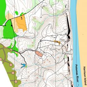
Sample Orienteering Map